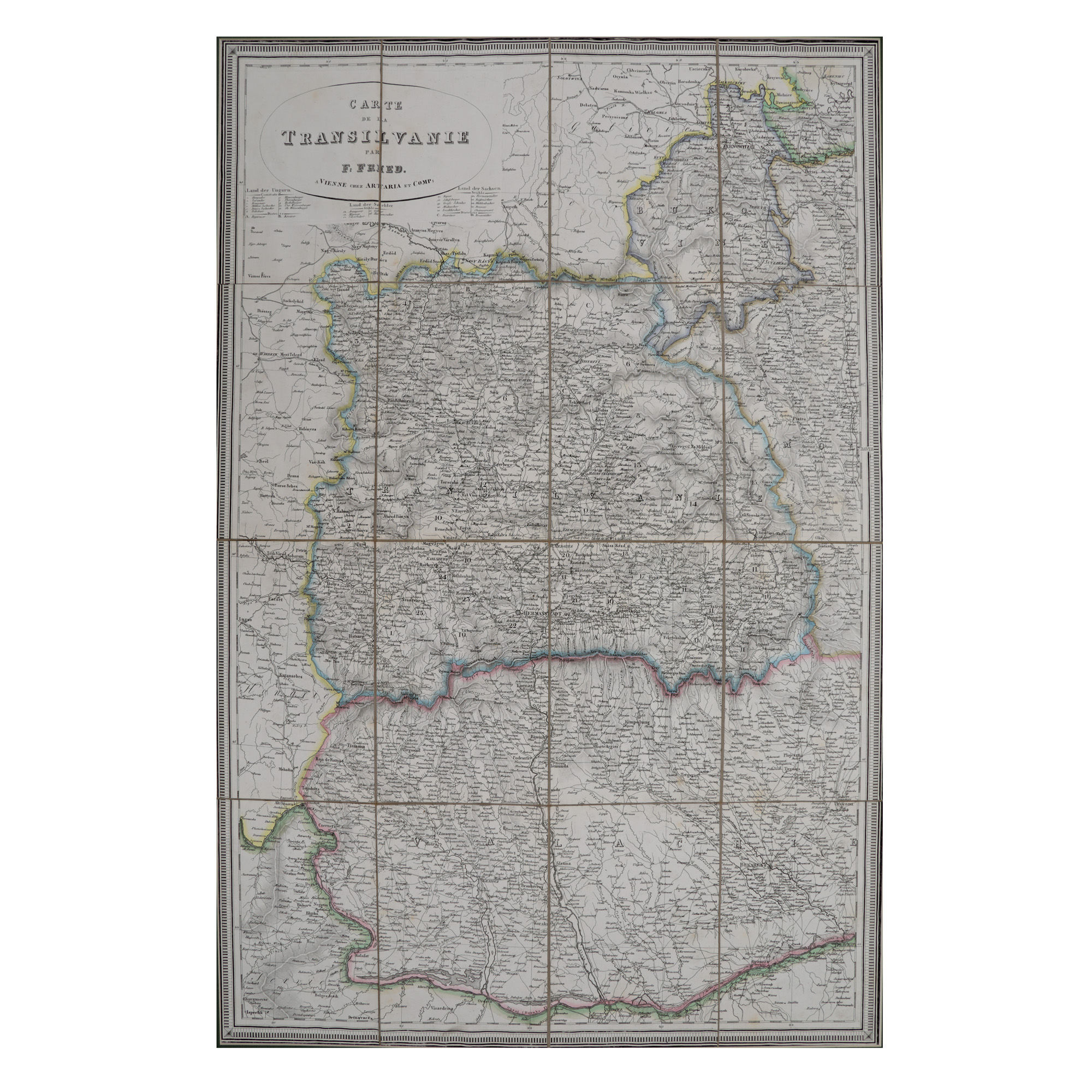
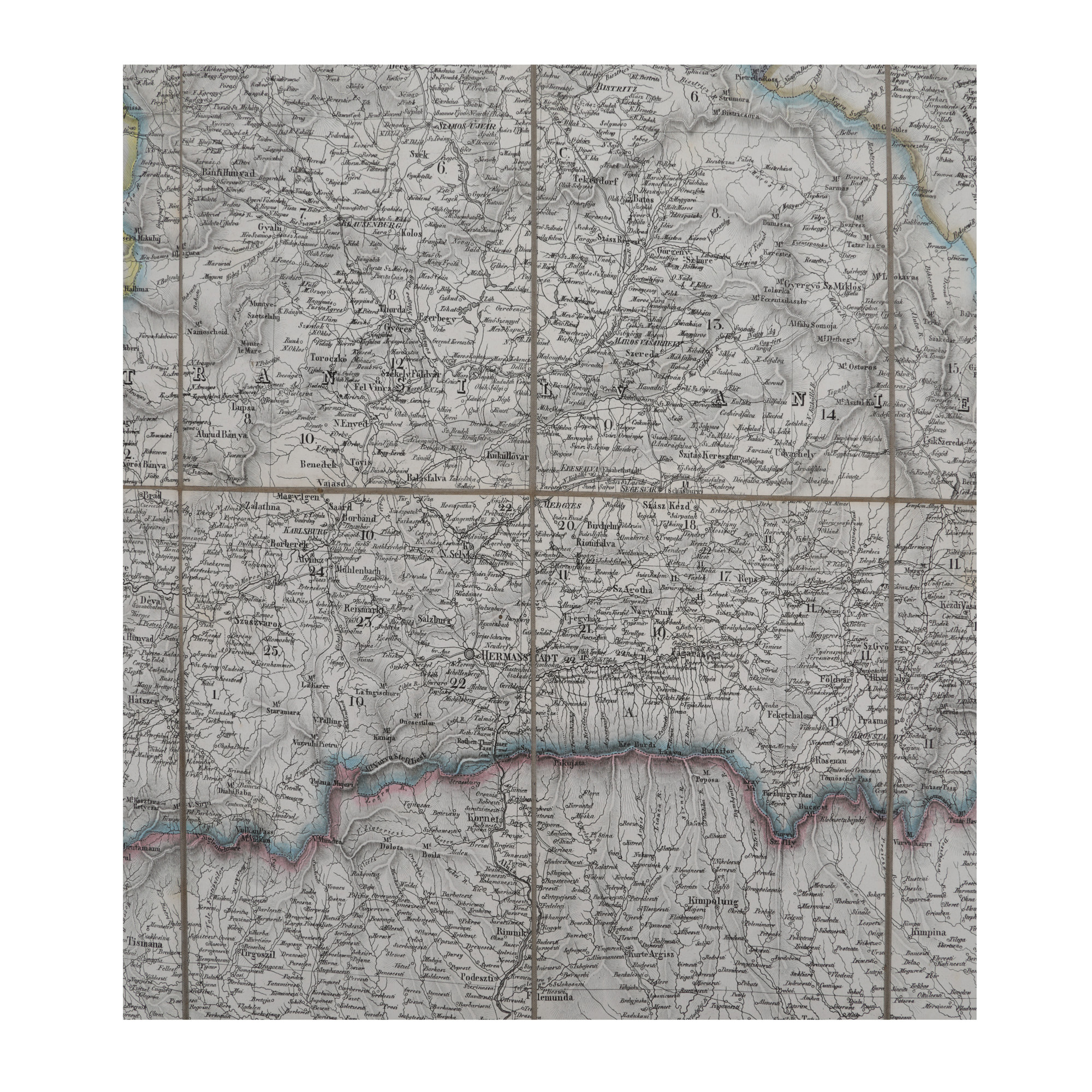

75. "Transylvania" map, made by F. Fried, Vienna, 19th century
Selling price
EUR 1.200
Session
Tue, 21 November 2023 19:00
Dimensions
width 56 cm, height 83 cm
Description
lithography on canvas
ADDITIONAL INFORMATION
For clarifications regarding the bidding procedure, hammer price costs, guarantee, payment, and collection terms for the winning lot, we recommend carefully reading/re-reading the Bidding Regulations.
For additional information regarding the lot and the auction, please contact the Art Consultants Department.
Detalii
ADDITIONAL INFORMATION
For clarifications regarding the bidding procedure, hammer price costs, guarantee, payment, and collection terms for the winning lot, we recommend carefully reading/re-reading the Bidding Regulations.
For additional information regarding the lot and the auction, please contact the Art Consultants Department.
Dimensions
width 56 cm, height 83 cm
Description
lithography on canvas
Similar lots
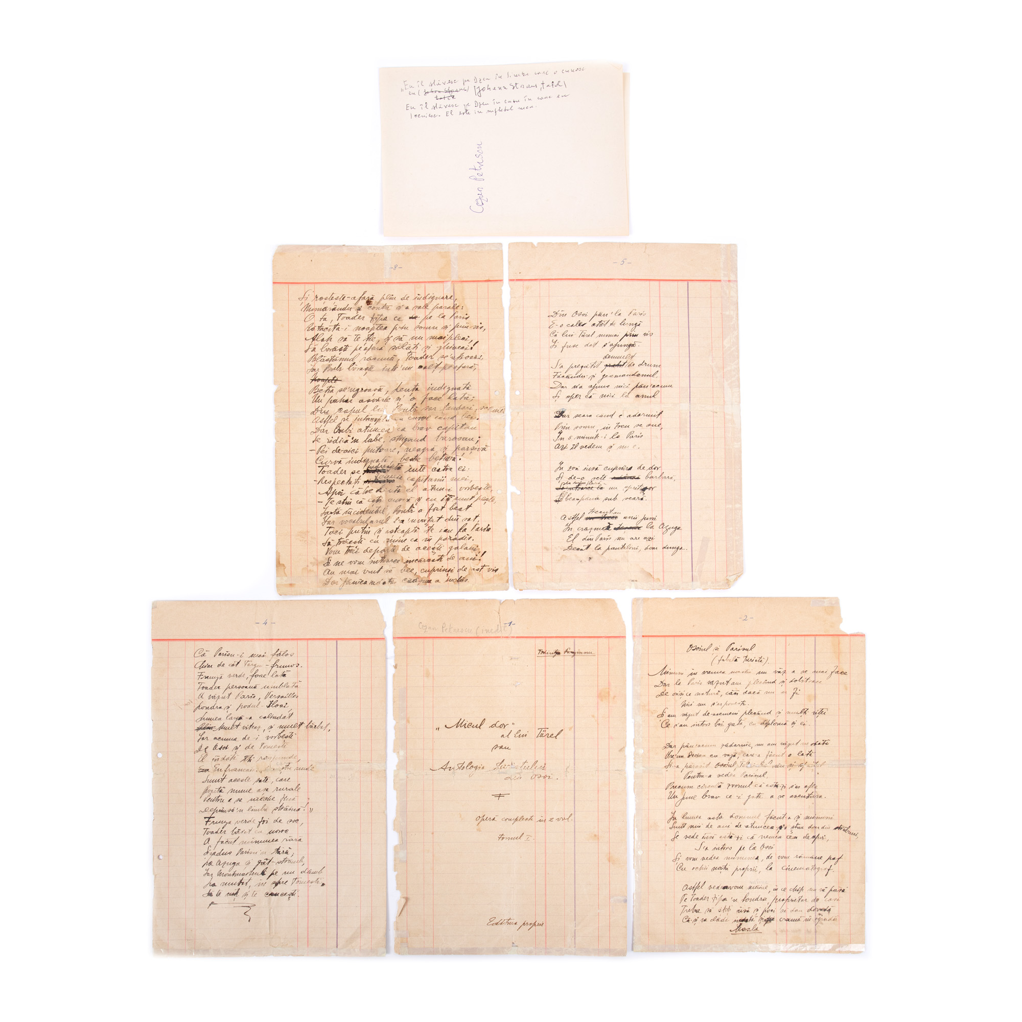
100. Literary manuscript "Micul dor al lui Türel" ("Türel’s Small Longing"), by Cezar Petrescu