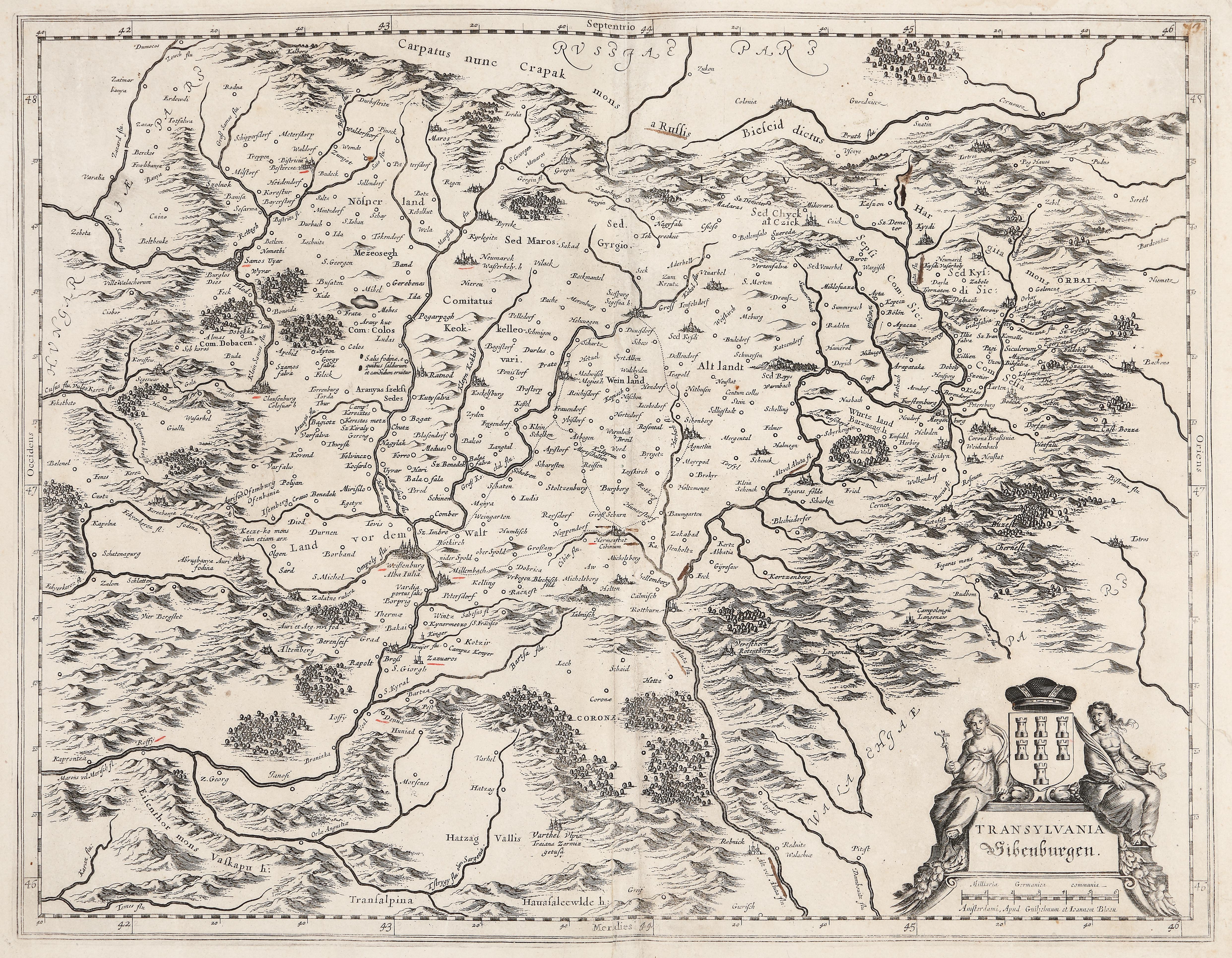
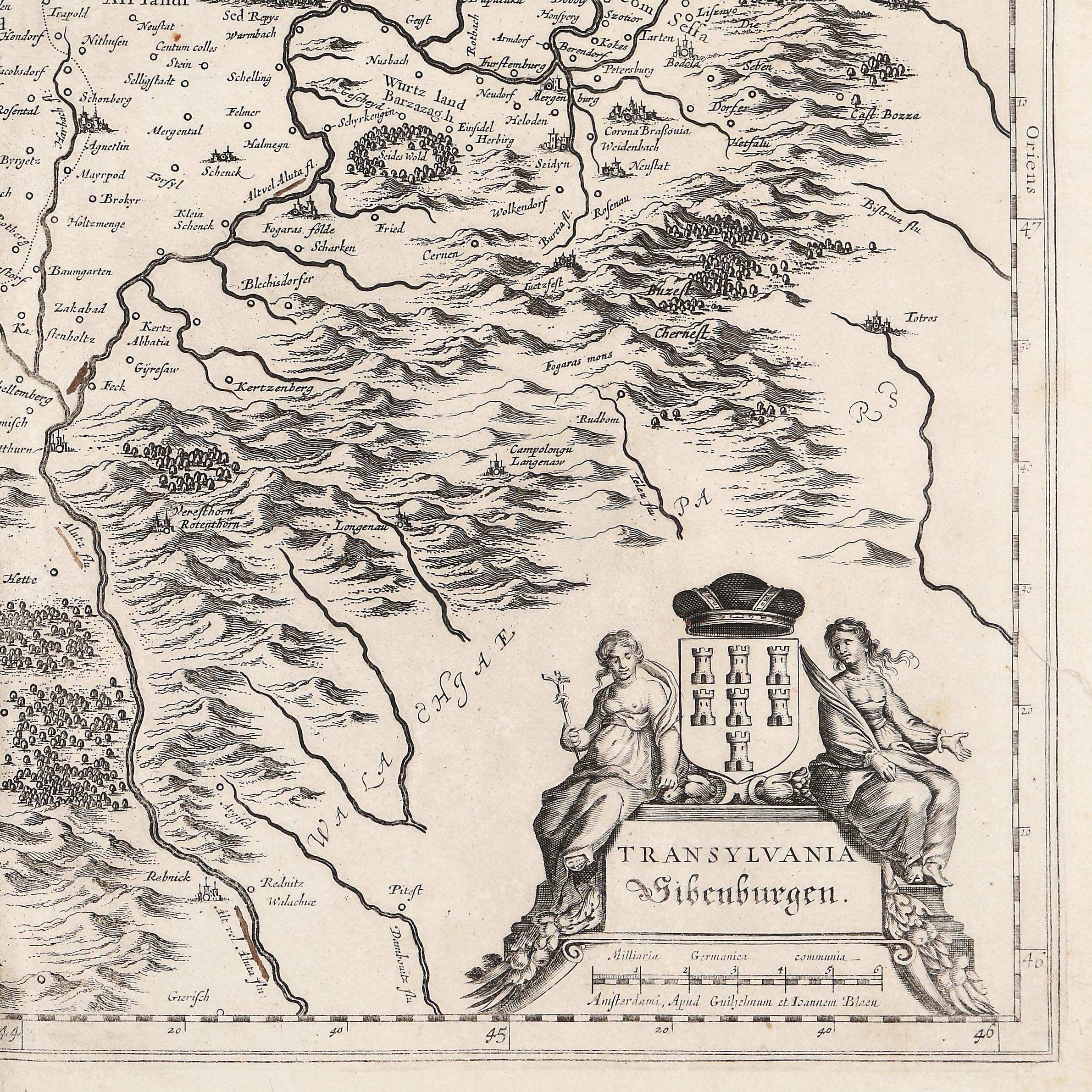
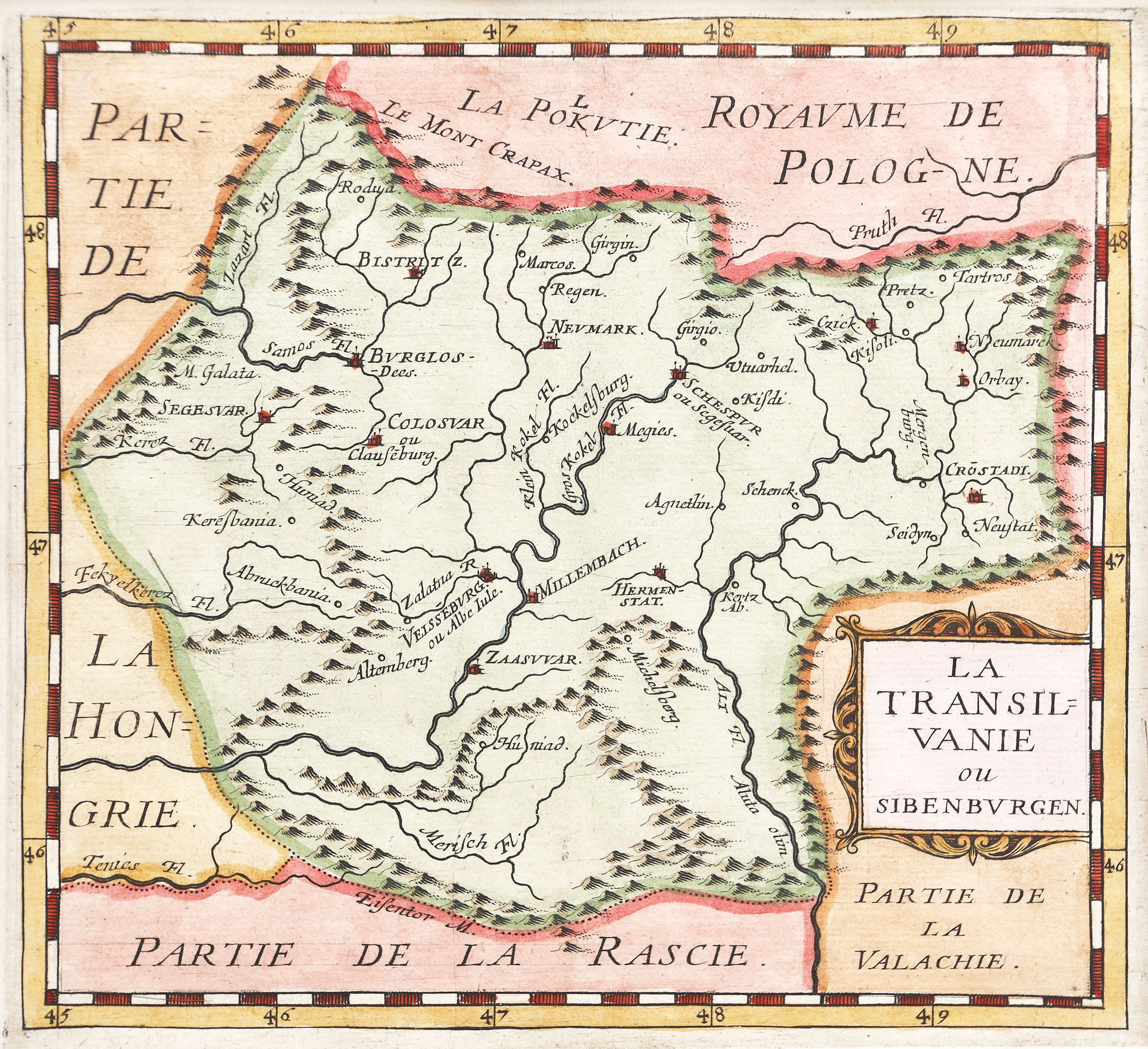
40. Map "Transylvania", by Willem Janszoon Blaeu, Amsterdam, approx. 1660, extremely rare collector's item
Starting price
EUR 250
Sold
EUR 1.000
Session
Tue, 5 April 2022 19:00
Dimensions
width 52 cm, height 41 cm, custom 41 Ã 52 cm
Description
copper engraving, laid paper
ADDITIONAL INFORMATION
For clarifications regarding the bidding procedure, hammer price costs, guarantee, payment, and collection terms for the winning lot, we recommend carefully reading/re-reading the Bidding Regulations.
For additional information regarding the lot and the auction, please contact the Art Consultants Department.
Detalii
ADDITIONAL INFORMATION
For clarifications regarding the bidding procedure, hammer price costs, guarantee, payment, and collection terms for the winning lot, we recommend carefully reading/re-reading the Bidding Regulations.
For additional information regarding the lot and the auction, please contact the Art Consultants Department.
Dimensions
width 52 cm, height 41 cm, custom 41 Ã 52 cm
Description
copper engraving, laid paper
Similar lots
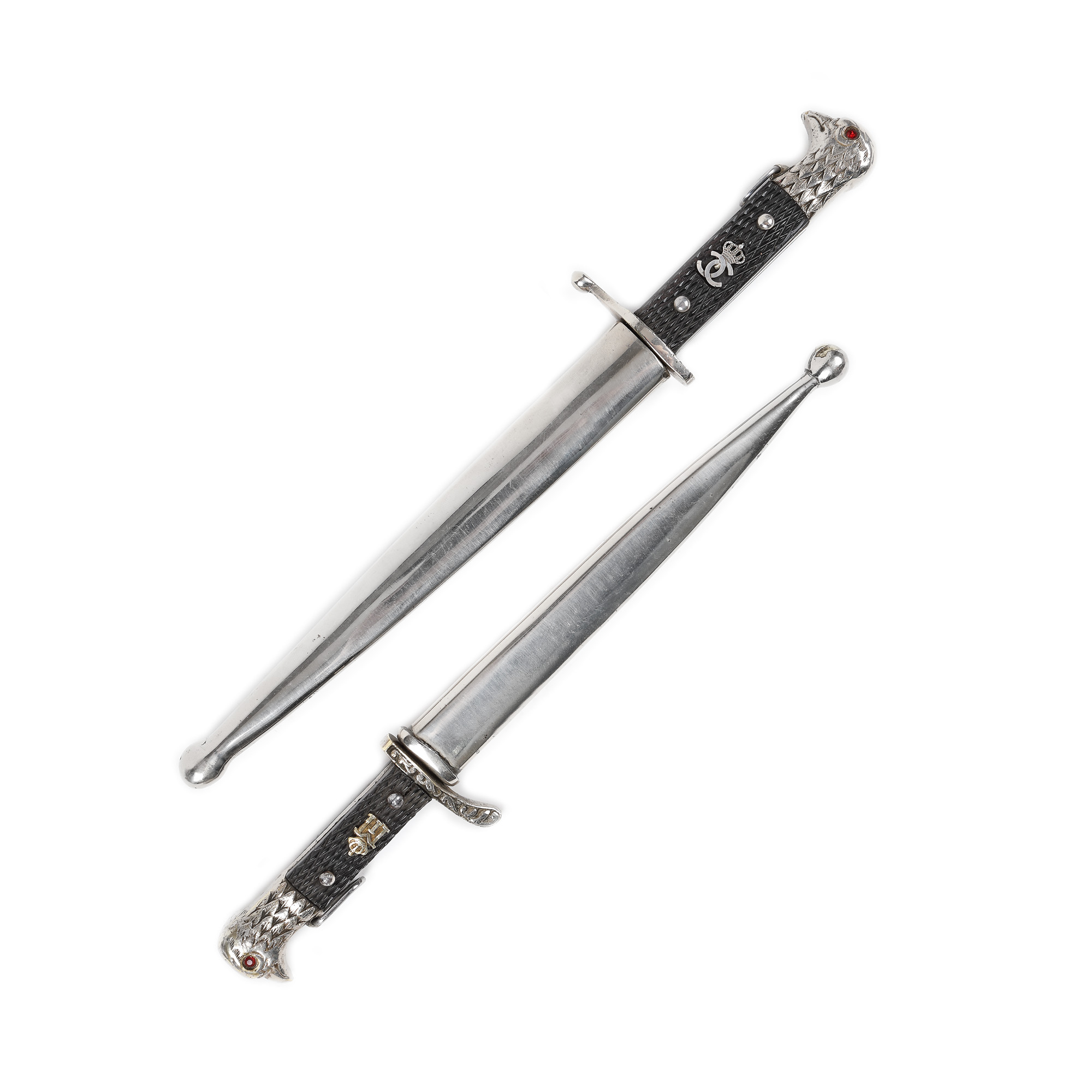
1. Two officer stilettos, with the monogram of kings Carol II and Michael, first half of the 20th century
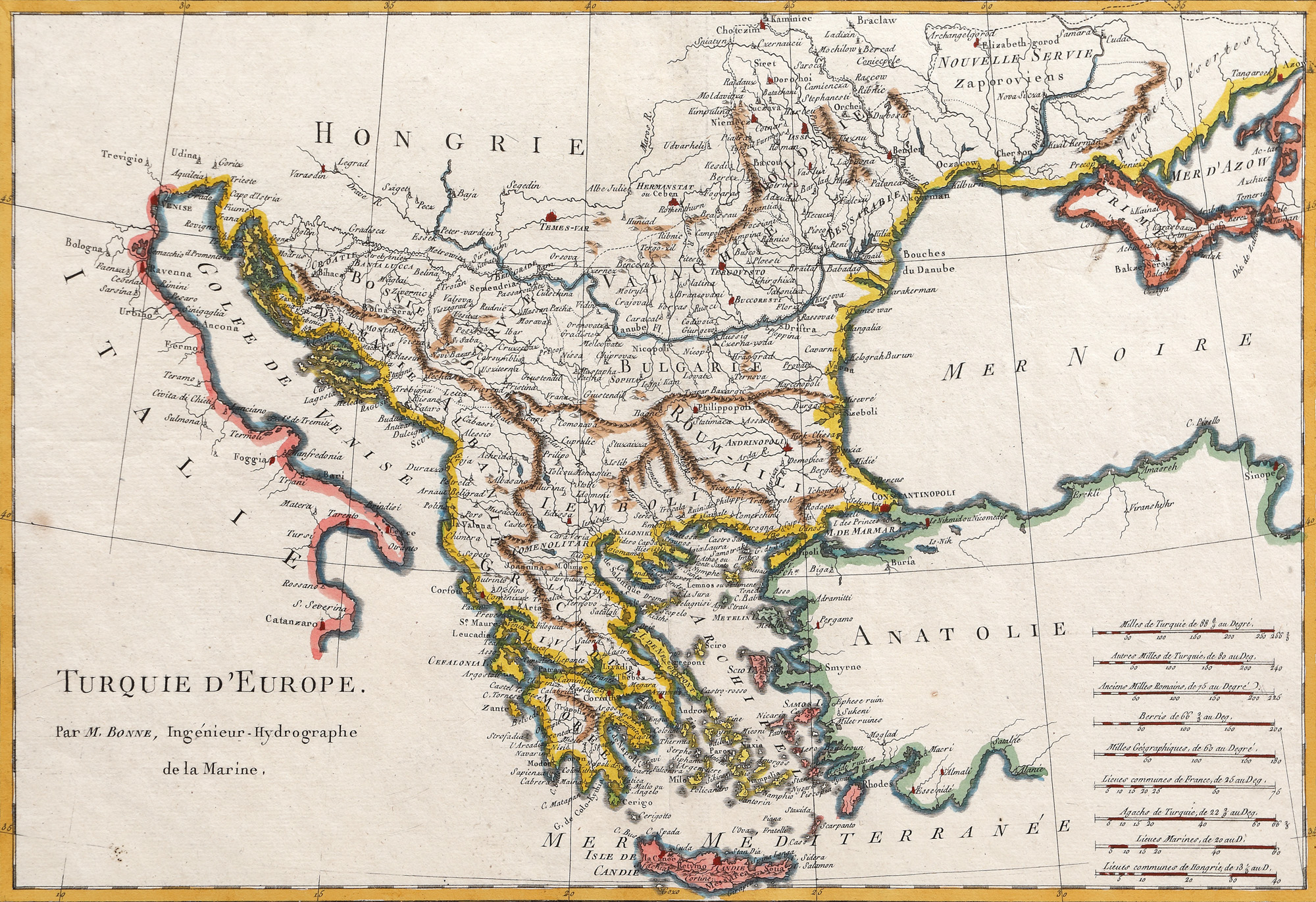
37. Map "Transylvania", by Philippe Briet, Paris, 1648, rare item