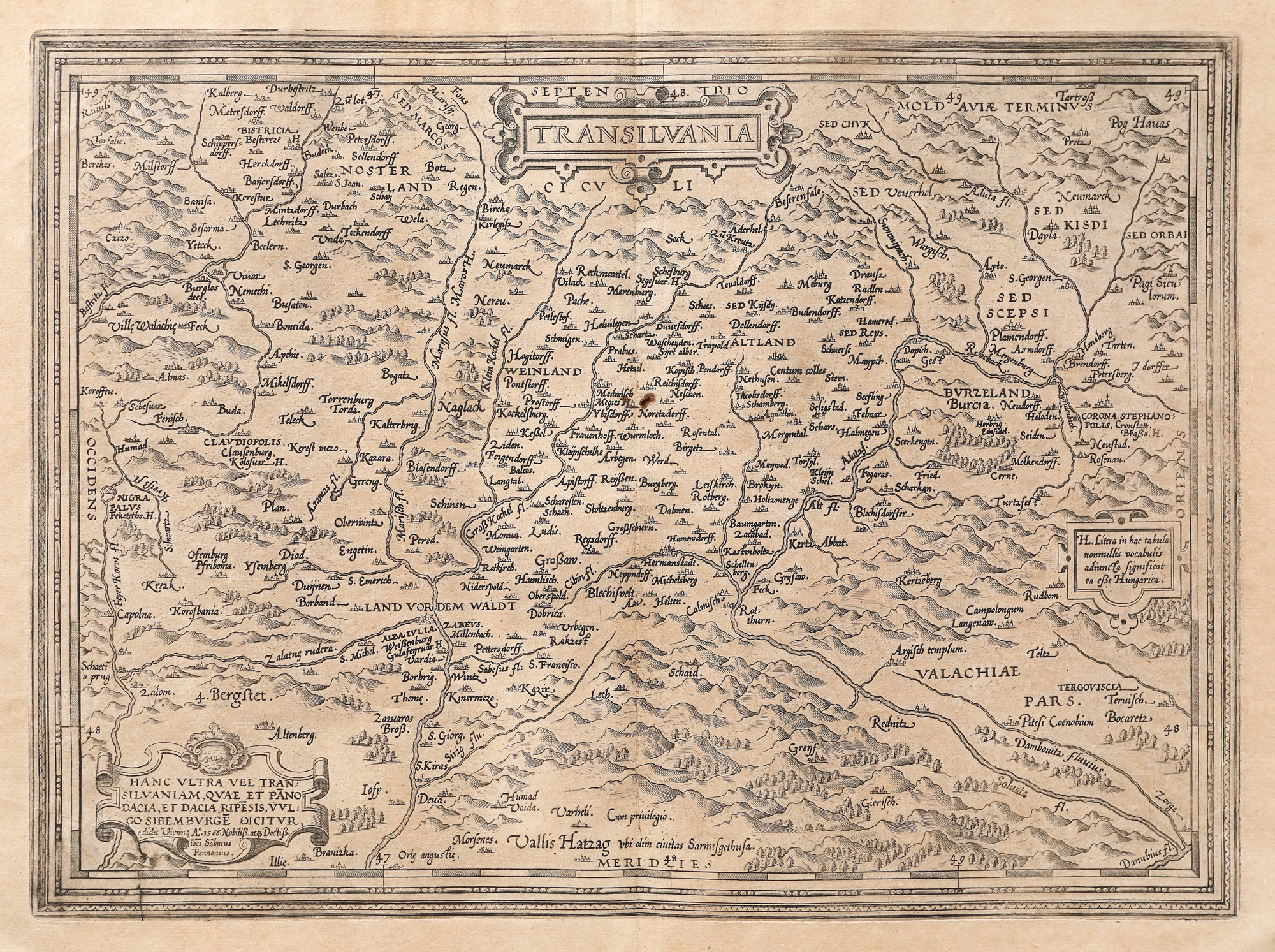
31. Map "Transylvania", by Johannes Sambucus, printed by Abraham Ortelius, 1575
Starting price
EUR 250
Sold
EUR 500
Session
Tue, 5 April 2022 19:00
Dimensions
custom 46 x 57 cm
Description
copper engraving
Research information
Orbis Terrarum edition.
ADDITIONAL INFORMATION
For clarifications regarding the bidding procedure, hammer price costs, guarantee, payment, and collection terms for the winning lot, we recommend carefully reading/re-reading the Bidding Regulations.
For additional information regarding the lot and the auction, please contact the Art Consultants Department.
Detalii
ADDITIONAL INFORMATION
For clarifications regarding the bidding procedure, hammer price costs, guarantee, payment, and collection terms for the winning lot, we recommend carefully reading/re-reading the Bidding Regulations.
For additional information regarding the lot and the auction, please contact the Art Consultants Department.
Dimensions
custom 46 x 57 cm
Description
copper engraving
Research information
Orbis Terrarum edition.
Similar lots
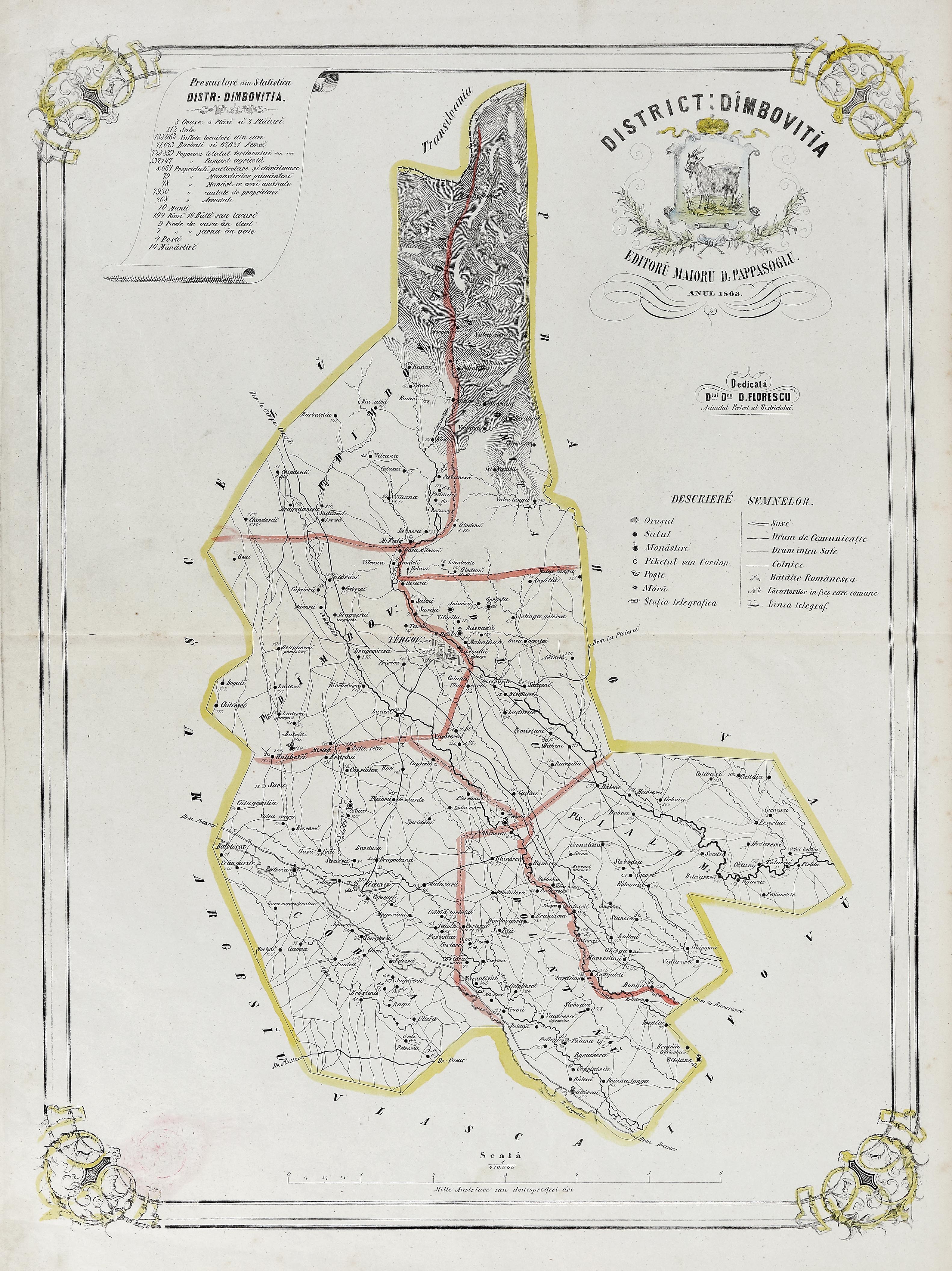
47. Map "Dâmbovița District", by Dimitrie Papazoglu, Bucharest, 1863, very rare item
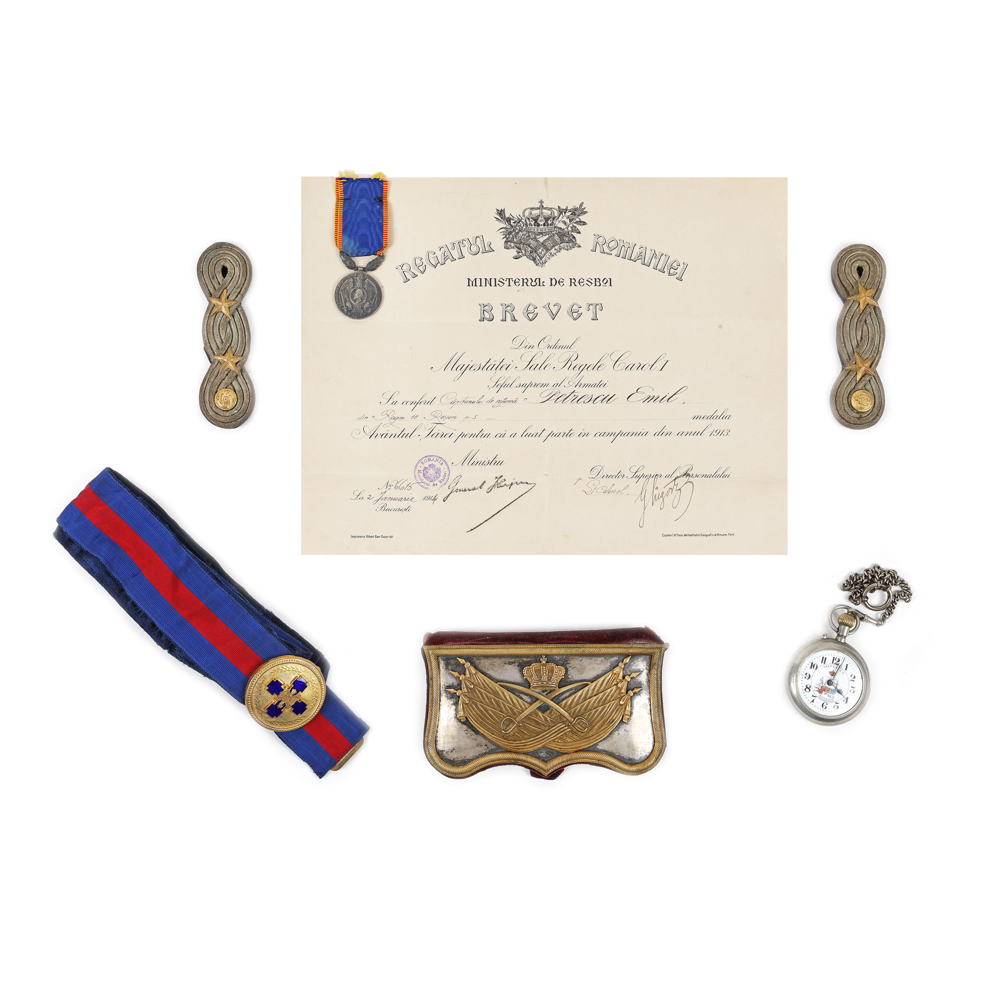
6. Military items that belonged to Captain Emil Petrescu, former prefect of Bucharest, early 20th century