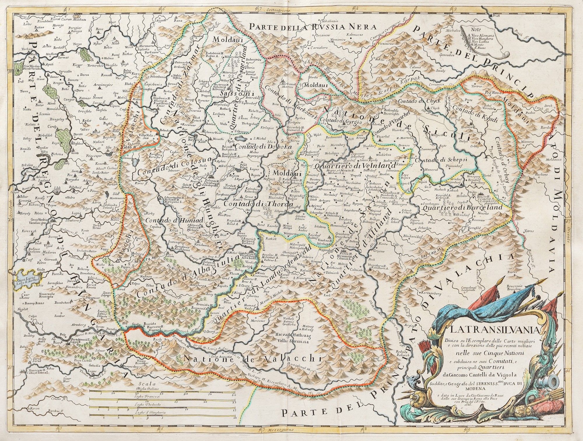
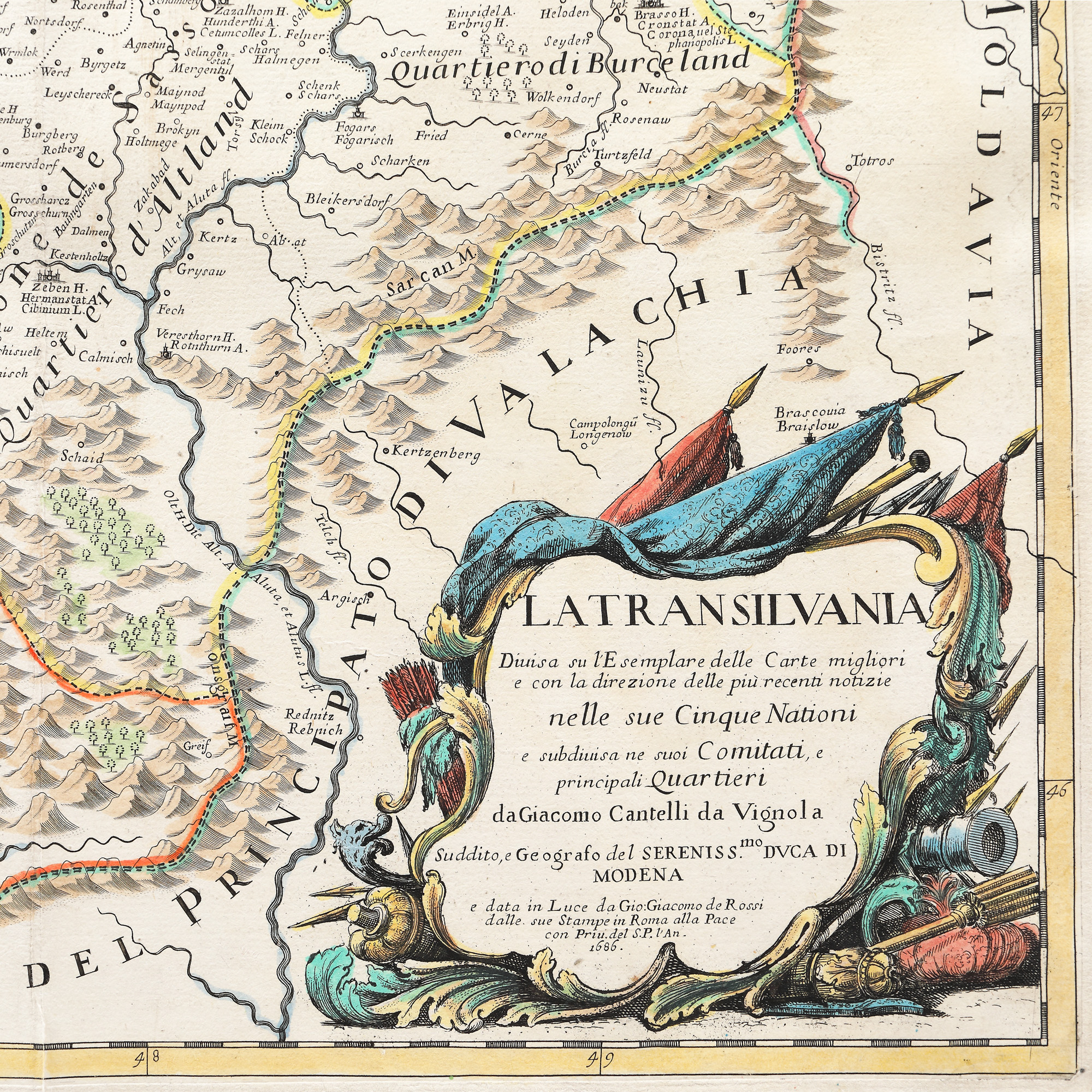
32. Map "Transylvania", Giovanni Giacomo de Rossi, Rome, 1686
Starting price
EUR 400
Sold
EUR 650
Session
Tue, 5 April 2022 19:00
Dimensions
custom 61 x 47 cm
Description
copper engraving, laid paper hand-coloured
ADDITIONAL INFORMATION
For clarifications regarding the bidding procedure, hammer price costs, guarantee, payment, and collection terms for the winning lot, we recommend carefully reading/re-reading the Bidding Regulations.
For additional information regarding the lot and the auction, please contact the Art Consultants Department.
Detalii
ADDITIONAL INFORMATION
For clarifications regarding the bidding procedure, hammer price costs, guarantee, payment, and collection terms for the winning lot, we recommend carefully reading/re-reading the Bidding Regulations.
For additional information regarding the lot and the auction, please contact the Art Consultants Department.
Dimensions
custom 61 x 47 cm
Description
copper engraving, laid paper hand-coloured
Similar lots
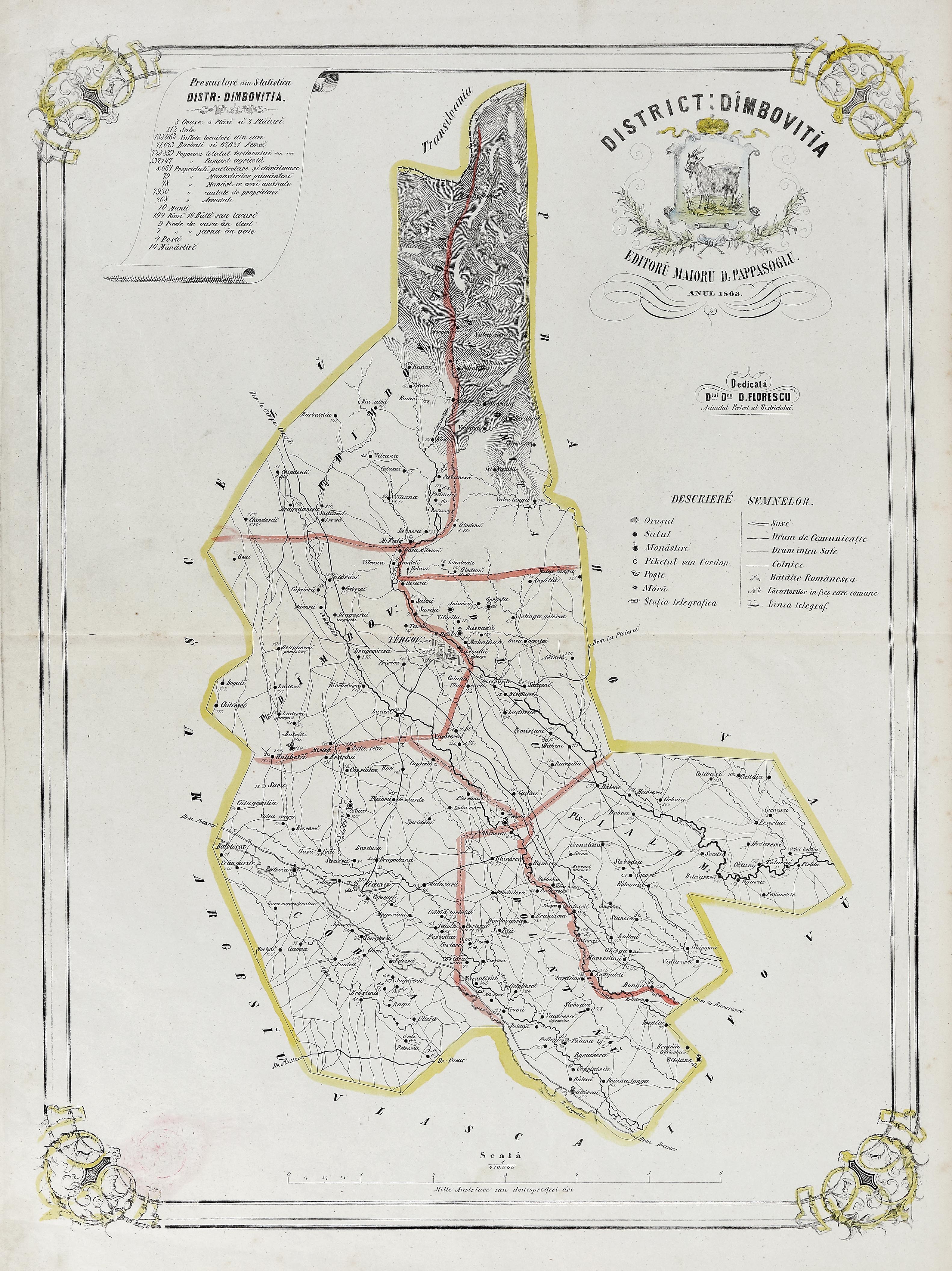
47. Map "Dâmbovița District", by Dimitrie Papazoglu, Bucharest, 1863, very rare item