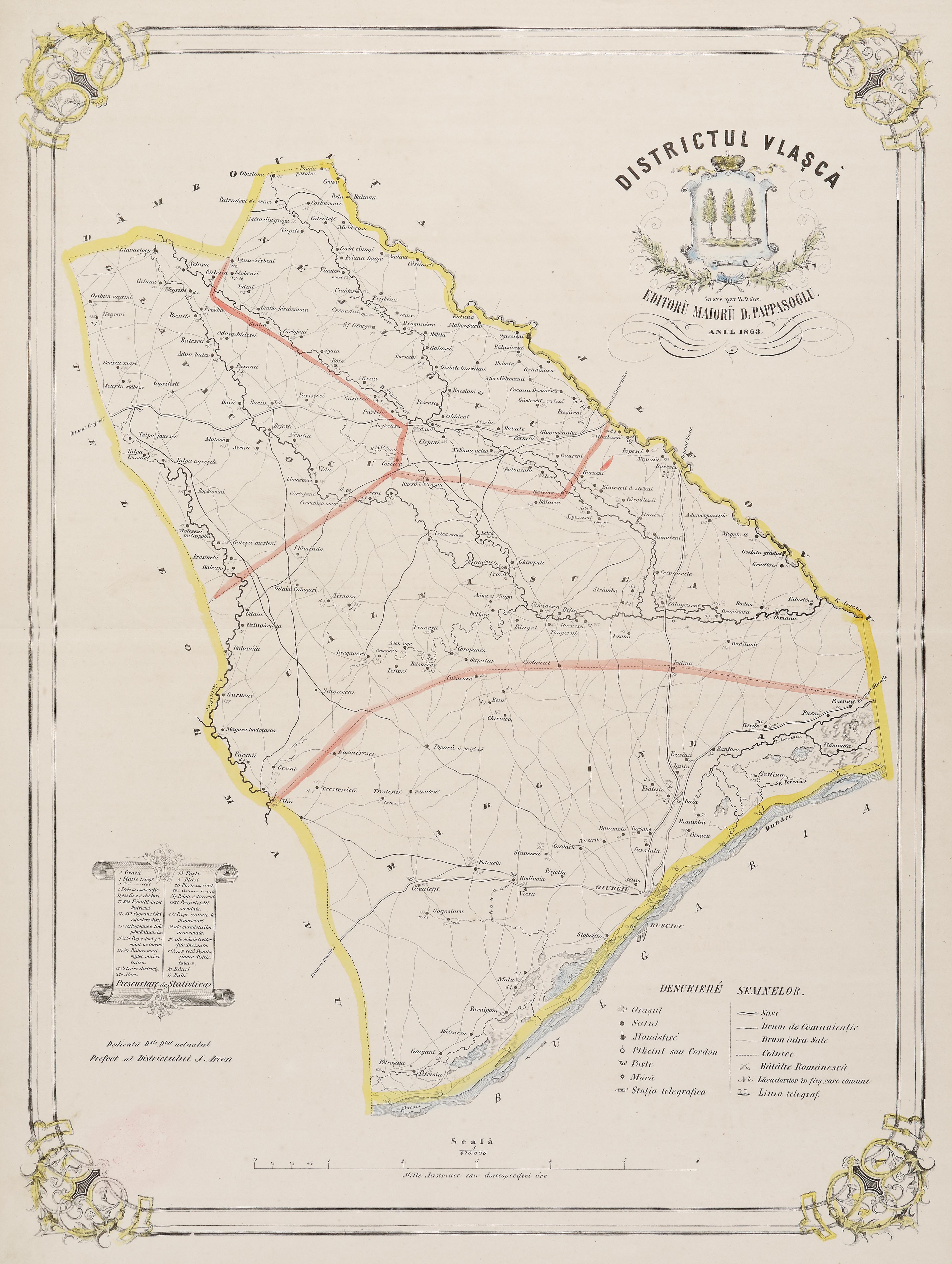
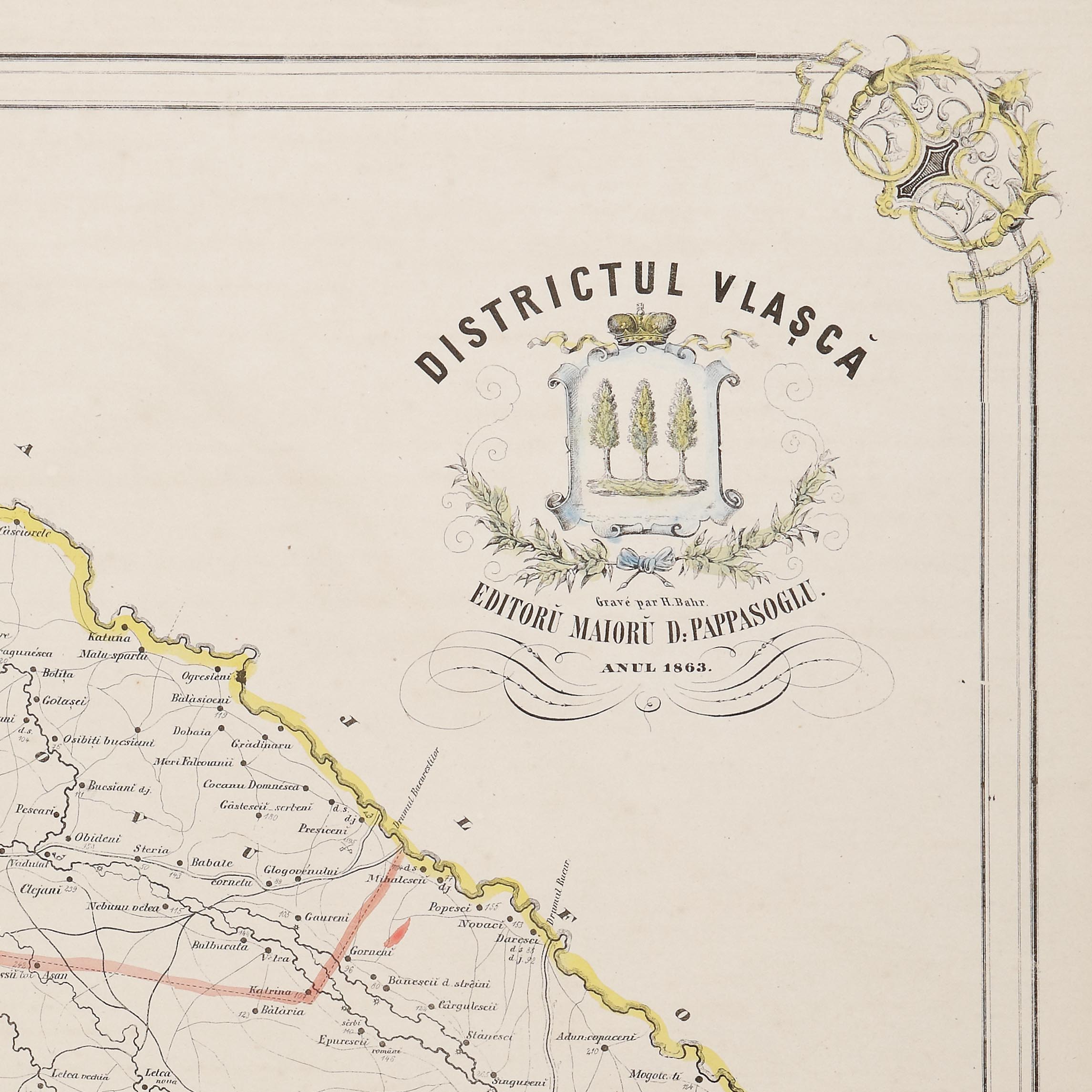
49. Map "Vlașcă District", by Dimitrie Papazoglu, Bucharest, 1863, very rare item
Selling price
EUR 600
Session
Tue, 5 April 2022 19:00
Dimensions
width 48.5 cm, height 66 cm, custom 66 Ã 48,5 cm
Description
chromolithography
ADDITIONAL INFORMATION
For clarifications regarding the bidding procedure, hammer price costs, guarantee, payment, and collection terms for the winning lot, we recommend carefully reading/re-reading the Bidding Regulations.
For additional information regarding the lot and the auction, please contact the Art Consultants Department.
Detalii
ADDITIONAL INFORMATION
For clarifications regarding the bidding procedure, hammer price costs, guarantee, payment, and collection terms for the winning lot, we recommend carefully reading/re-reading the Bidding Regulations.
For additional information regarding the lot and the auction, please contact the Art Consultants Department.
Dimensions
width 48.5 cm, height 66 cm, custom 66 Ã 48,5 cm
Description
chromolithography
Similar lots
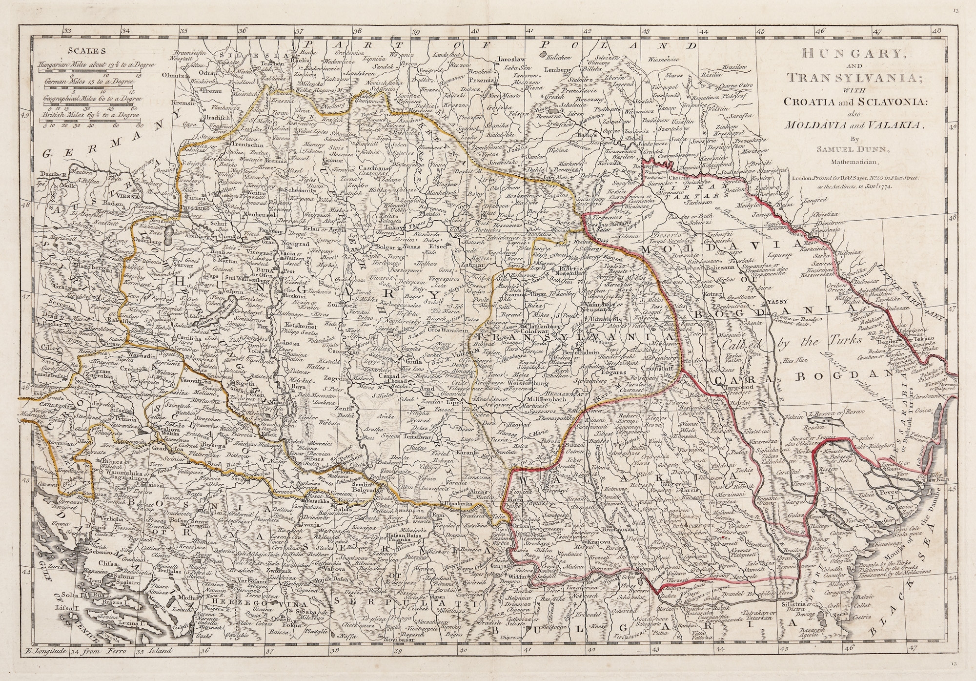
65. Map "Hungary, Transylvania, Croatia, Slovakia, Moldavia and Wallachia", by Samuel Dunn, London, 1774