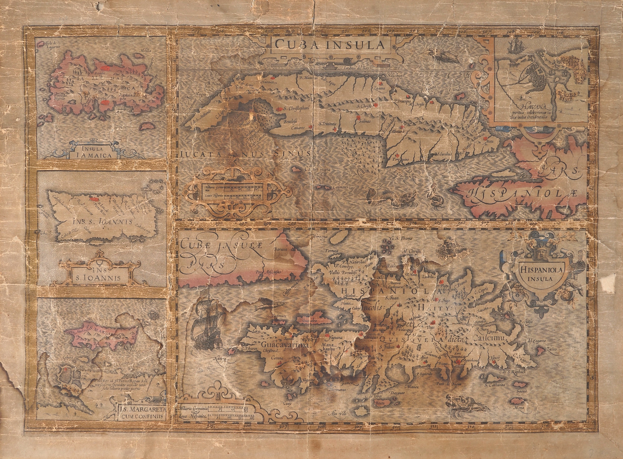
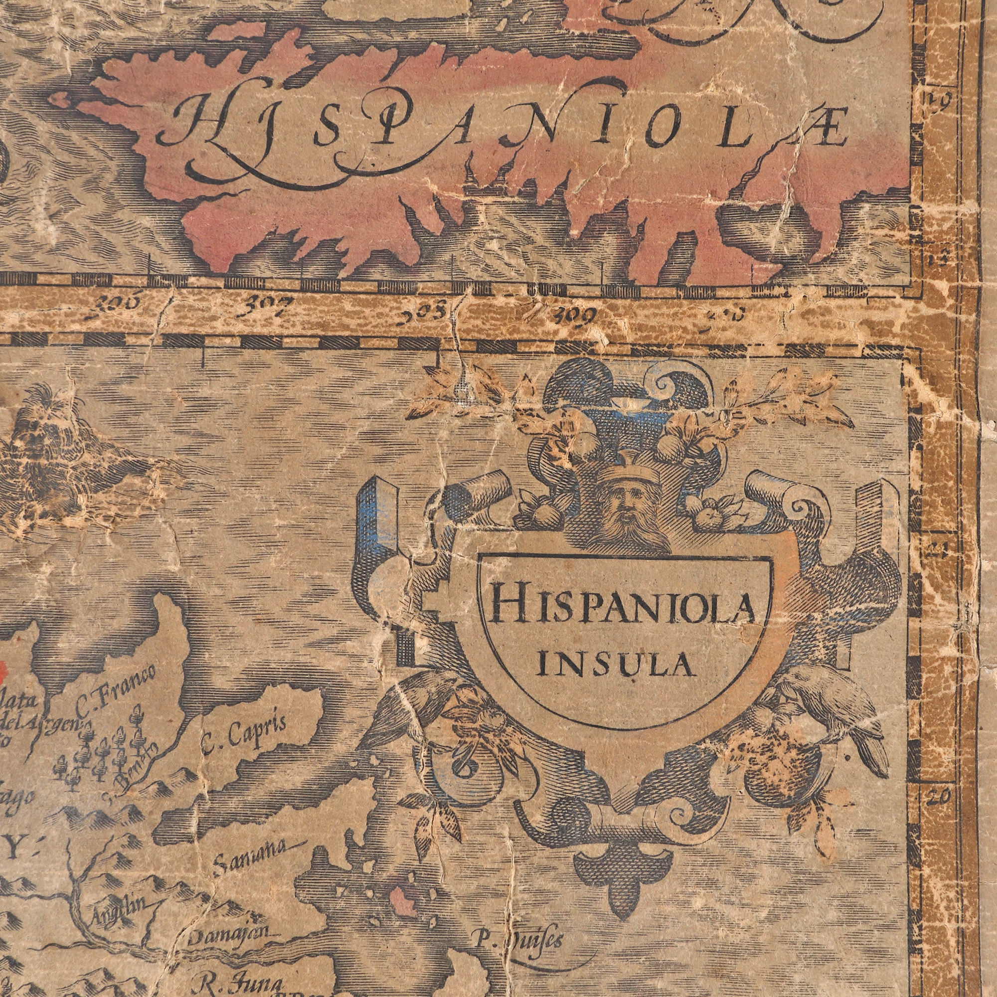
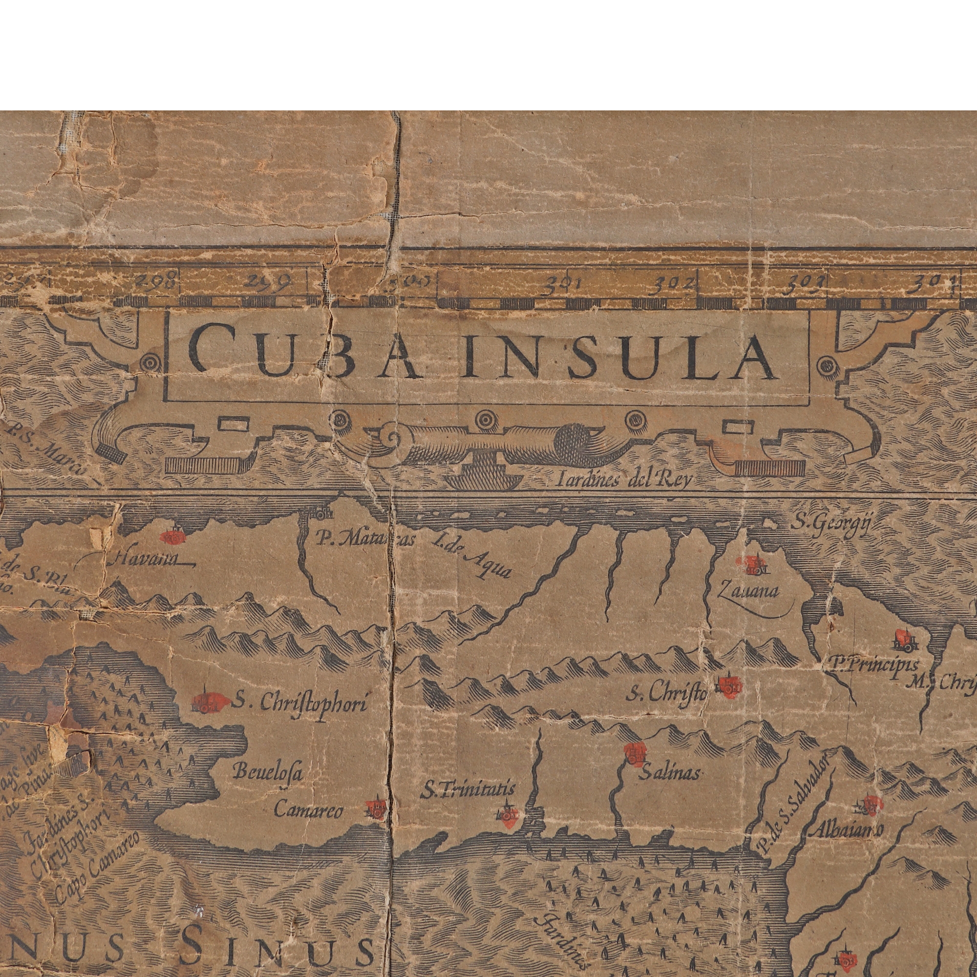
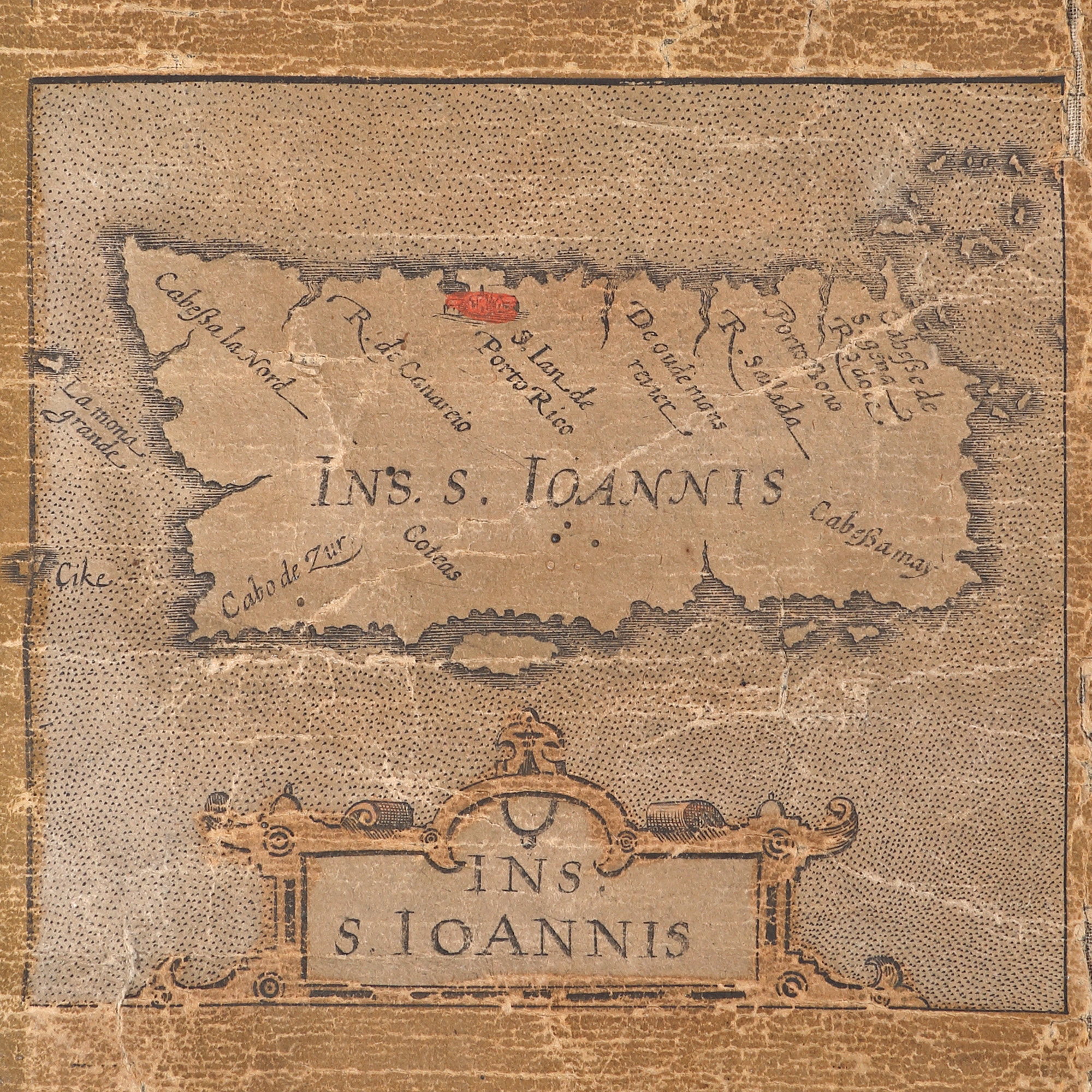
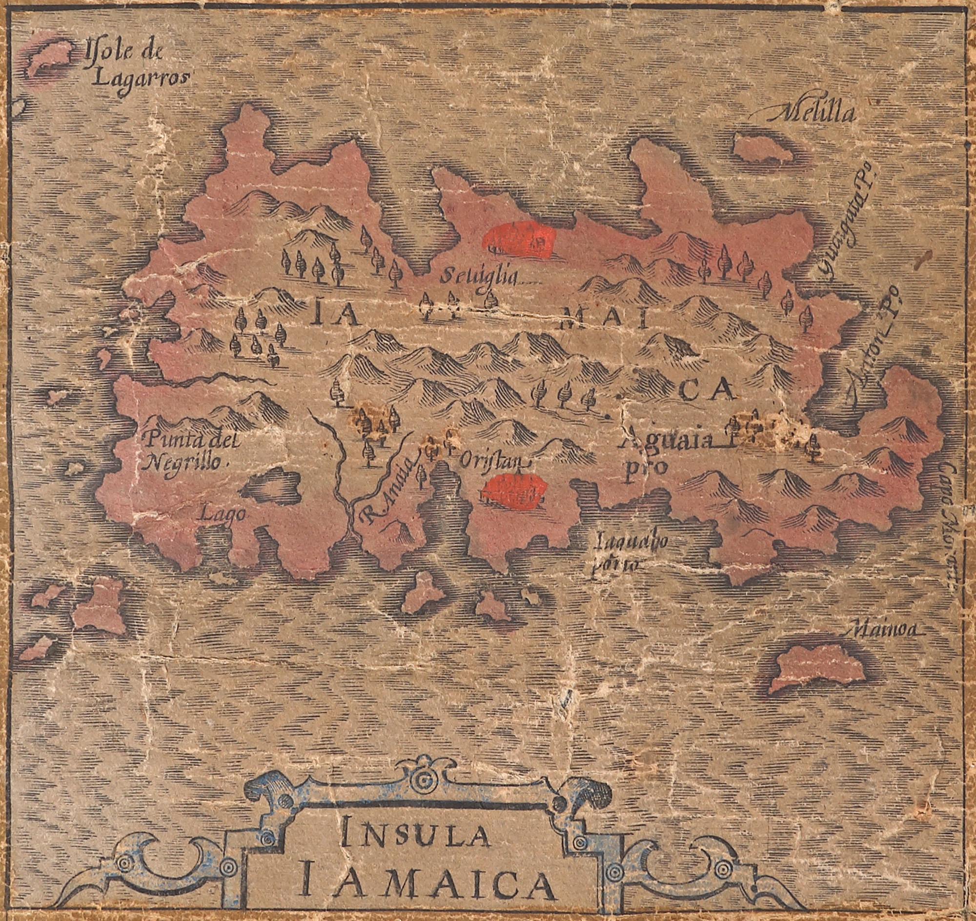
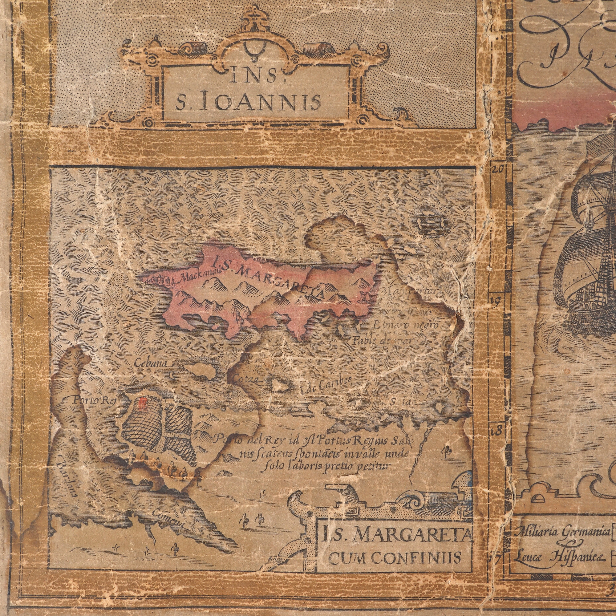
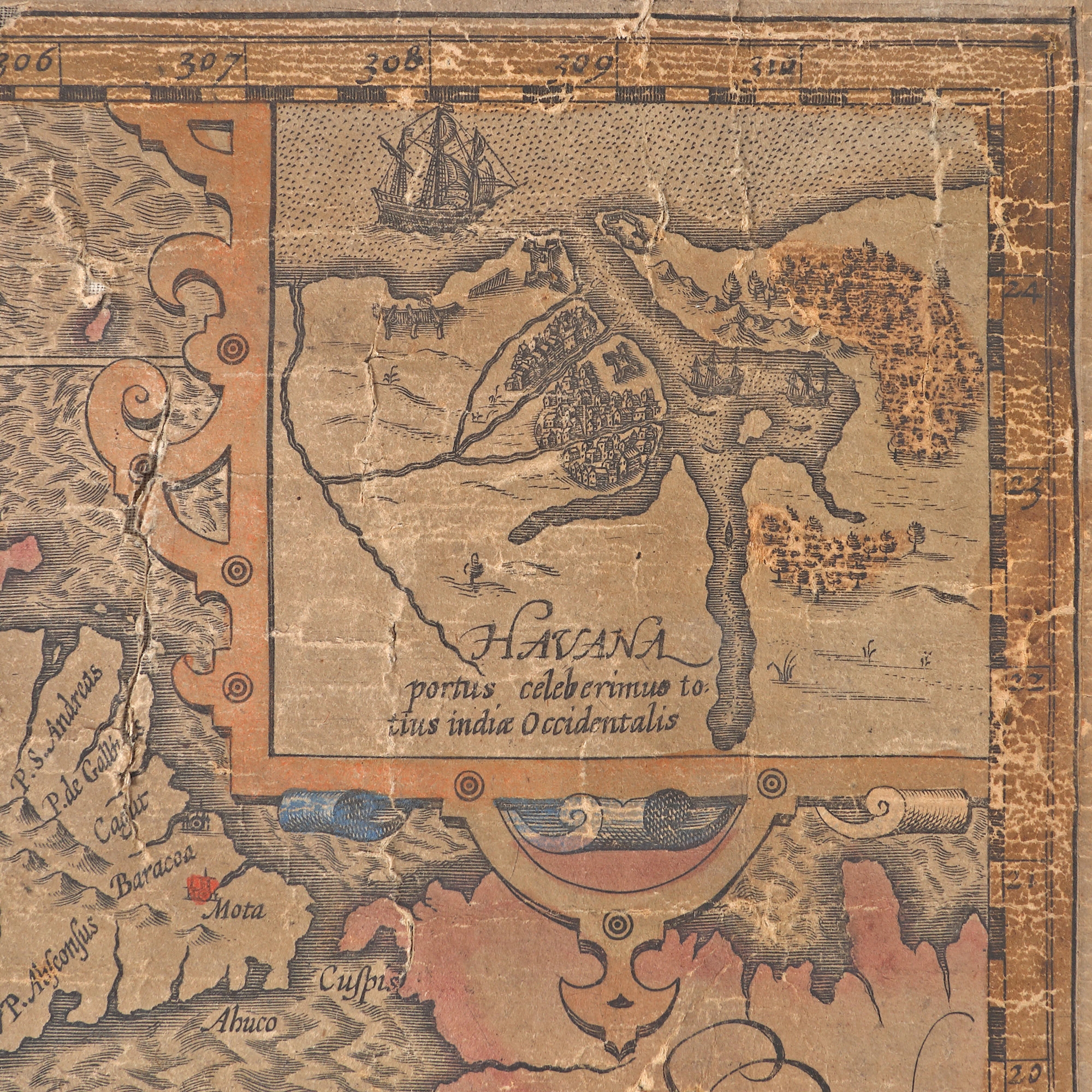
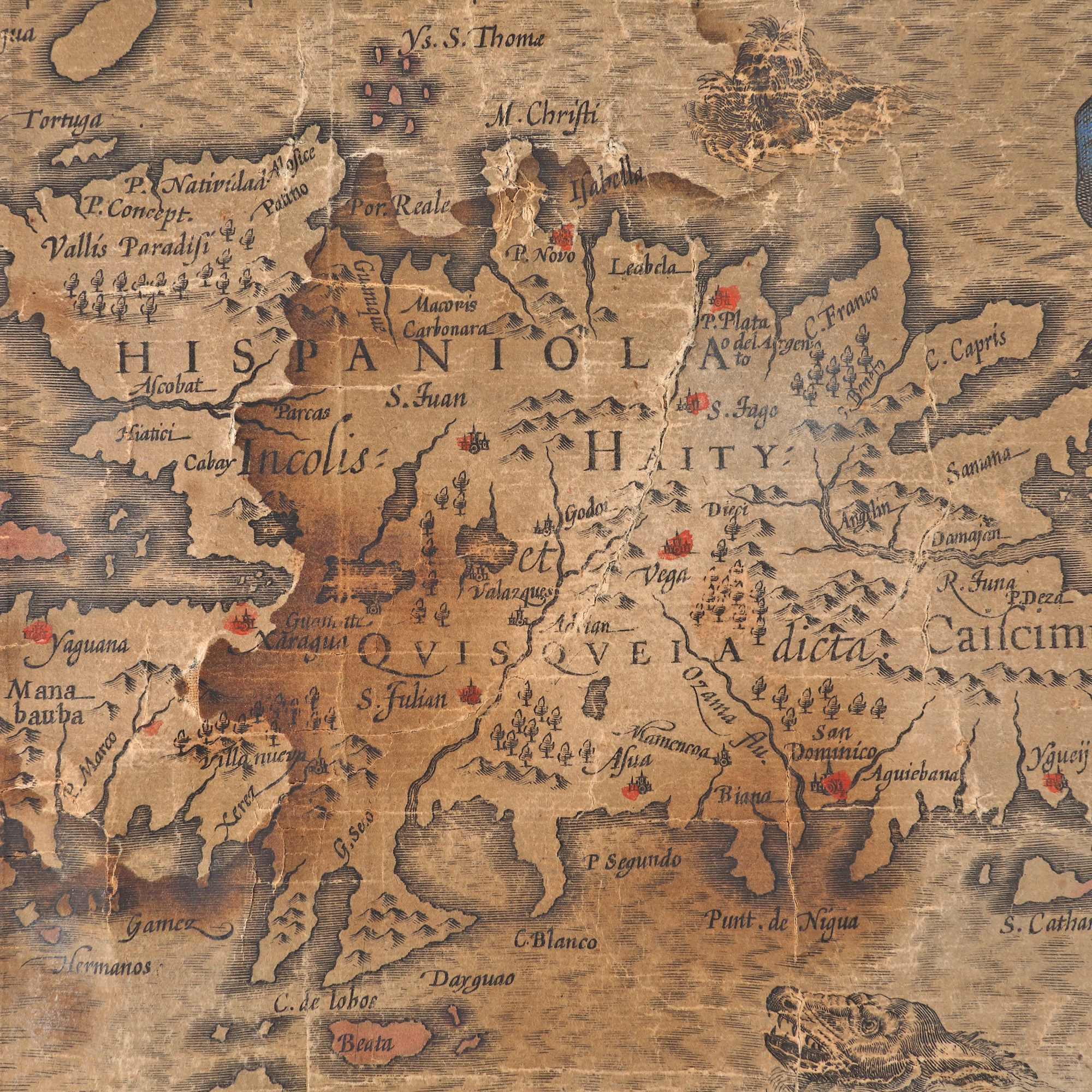
310. "Greater Antilles. The islands of Cuba, Hispaniola, Jamaica, St. John (Puerto Rico), Margaret (West Indies)" map by Gerardus Mercator, 1569, published by Hendrik Hondius II, Amsterdam, 1633
Selling price
EUR 450
Session
Fri, 31 March 2023 12:00
Dimensions
width 60 cm, height 44 cm
Description
copper engraving, hand-coloured laid paper
ADDITIONAL INFORMATION
For clarifications regarding the bidding procedure, hammer price costs, guarantee, payment, and collection terms for the winning lot, we recommend carefully reading/re-reading the Bidding Regulations.
For additional information regarding the lot and the auction, please contact the Art Consultants Department.
Detalii
ADDITIONAL INFORMATION
For clarifications regarding the bidding procedure, hammer price costs, guarantee, payment, and collection terms for the winning lot, we recommend carefully reading/re-reading the Bidding Regulations.
For additional information regarding the lot and the auction, please contact the Art Consultants Department.
Dimensions
width 60 cm, height 44 cm
Description
copper engraving, hand-coloured laid paper
Similar lots
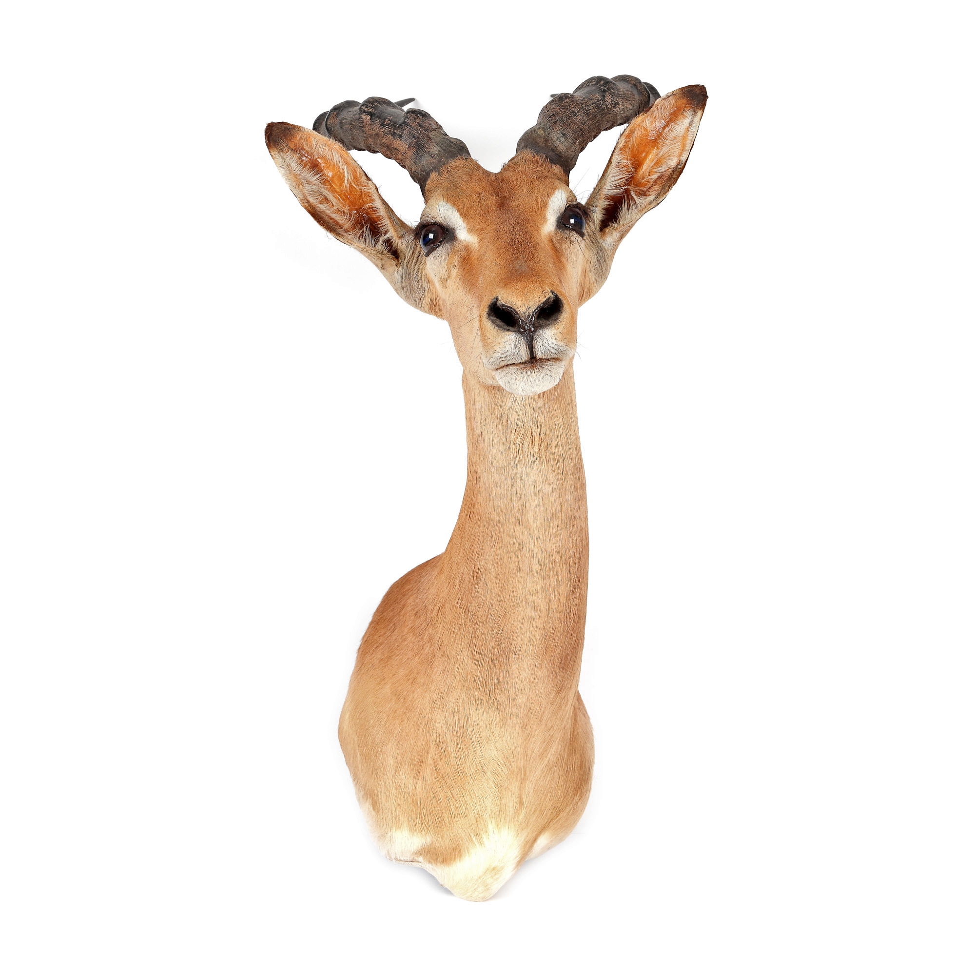
311. Impala gazelle trophy, with long horns, from the Jean-Philippe Guilbert collection
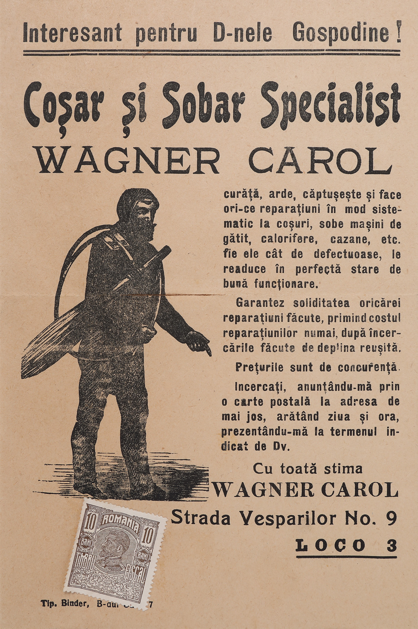
333. Announcement "Wagner Carol. Coșar și Sobar Specialist" (Chimney-sweeper and stove repair), approx. 1915
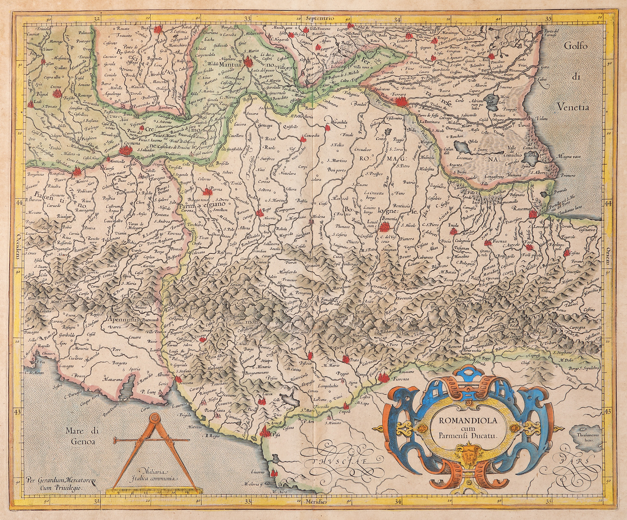
314. "Rumandiola and the Duchy of Parma" map by Gerardus Mercator, Amsterdam, 1595