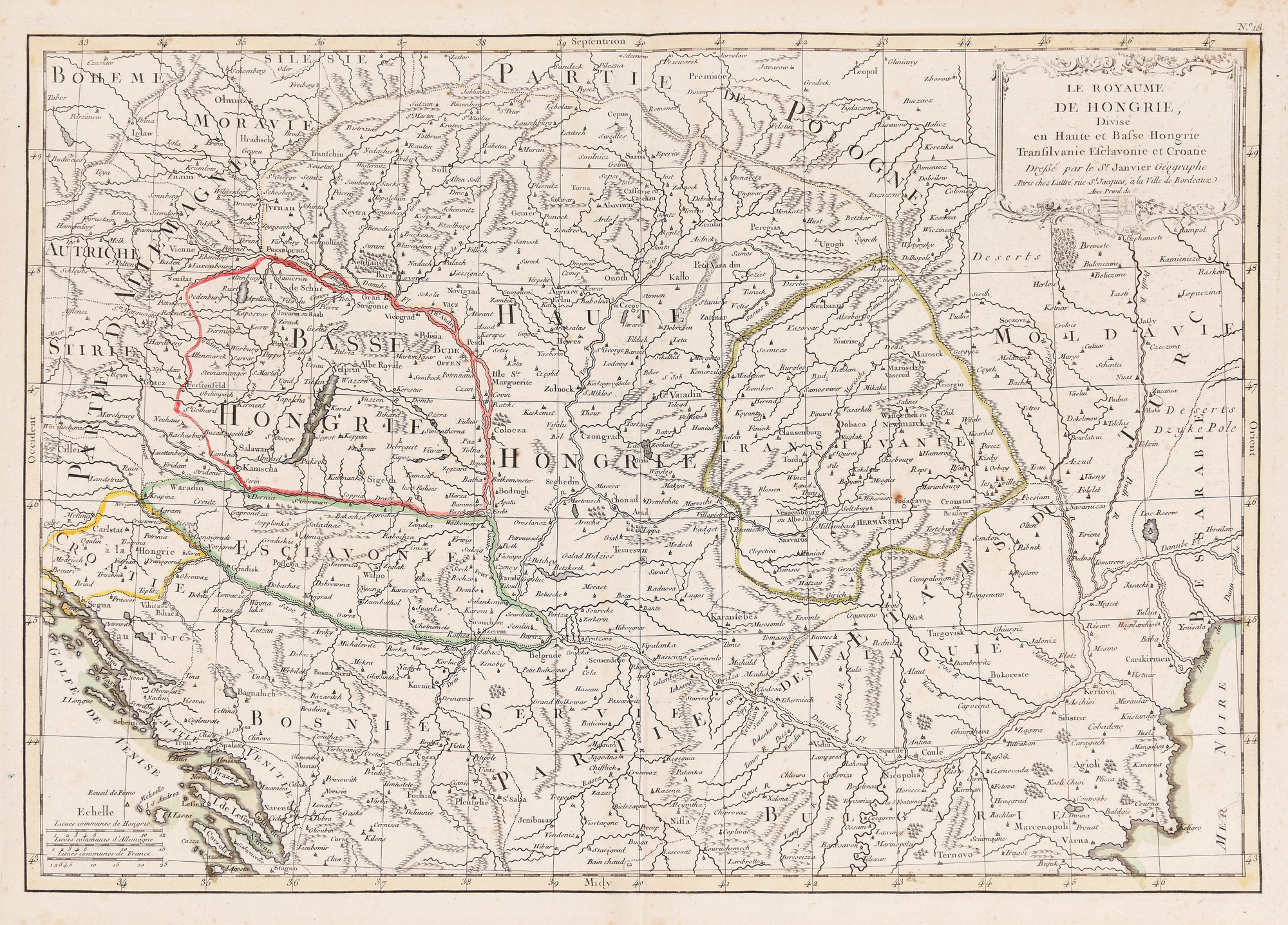
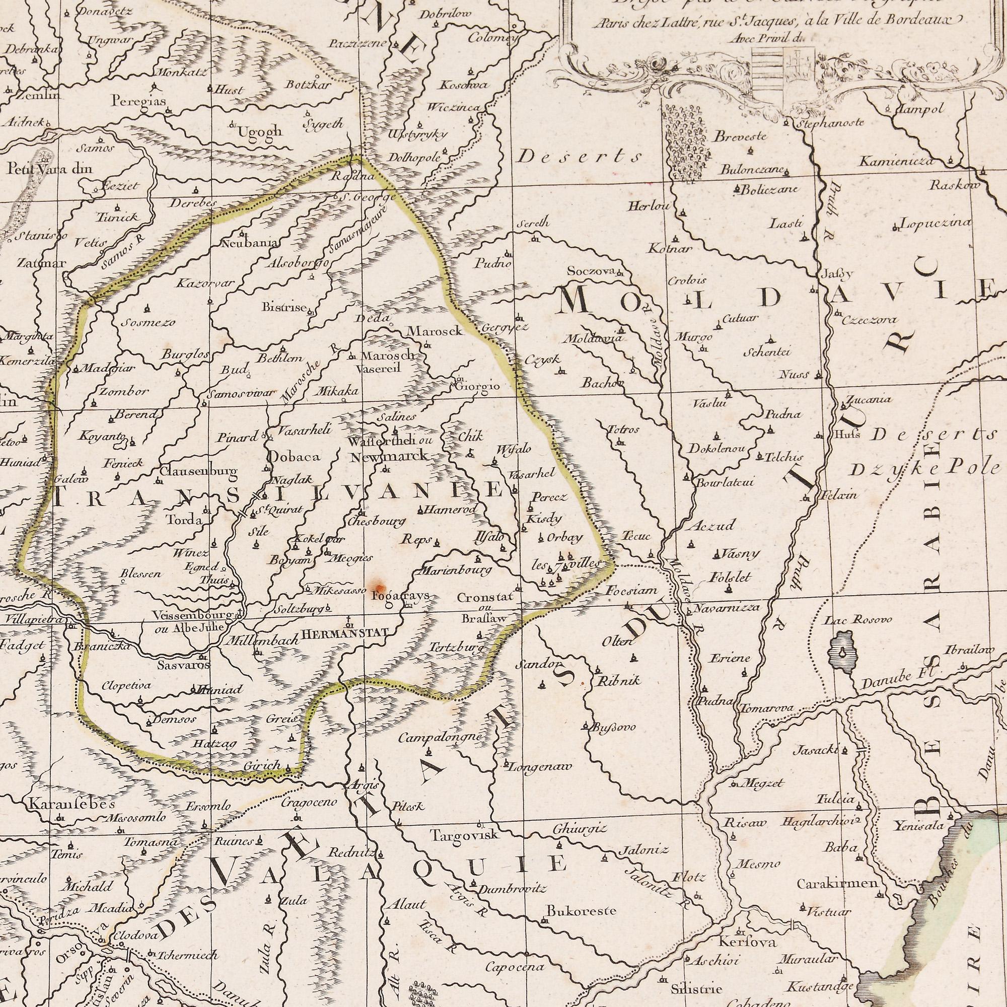
245. "Kingdom of Hungary" map, by Robert Janvier, approx. 1770
Starting price
EUR 100
Sold
EUR 400
Session
Tue, 19 July 2022 19:00
Dimensions
width 44.5 cm, height 31 cm, custom 31 Ã 44.5 cm
Description
metal engraving, striped paper
ADDITIONAL INFORMATION
For clarifications regarding the bidding procedure, hammer price costs, guarantee, payment, and collection terms for the winning lot, we recommend carefully reading/re-reading the Bidding Regulations.
For additional information regarding the lot and the auction, please contact the Art Consultants Department.
Detalii
ADDITIONAL INFORMATION
For clarifications regarding the bidding procedure, hammer price costs, guarantee, payment, and collection terms for the winning lot, we recommend carefully reading/re-reading the Bidding Regulations.
For additional information regarding the lot and the auction, please contact the Art Consultants Department.
Dimensions
width 44.5 cm, height 31 cm, custom 31 Ã 44.5 cm
Description
metal engraving, striped paper
Similar lots
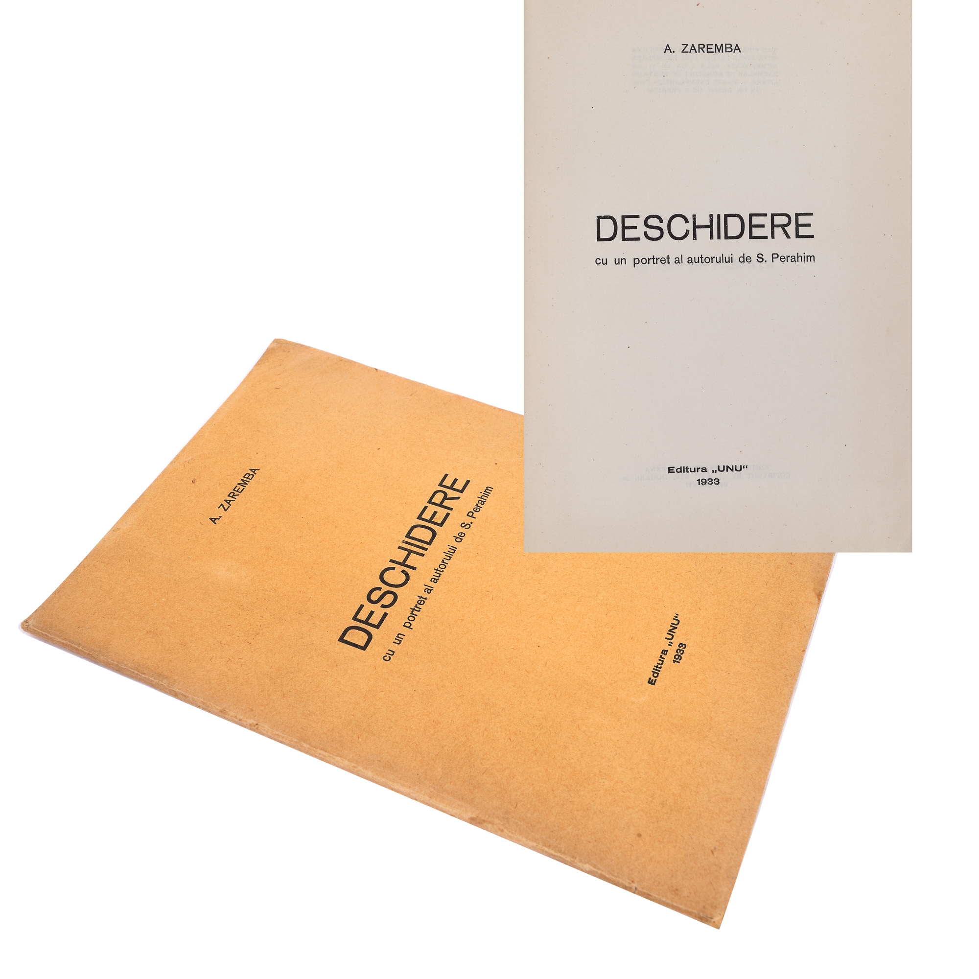
119. "Deschidere", by Aurel Zaremba, Bucharest, 1933, edited by Sașa Pană, "Unu" Publishing House