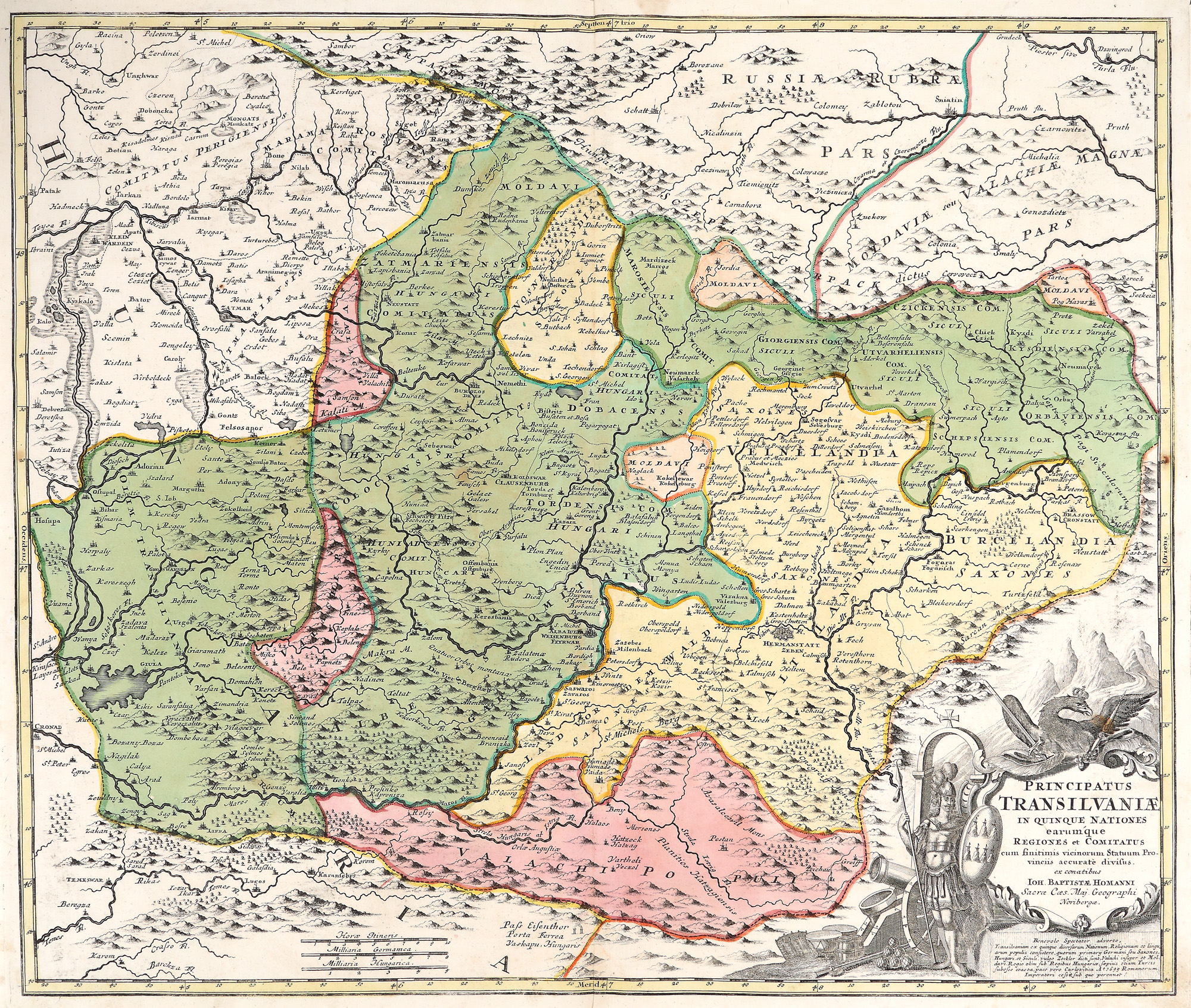
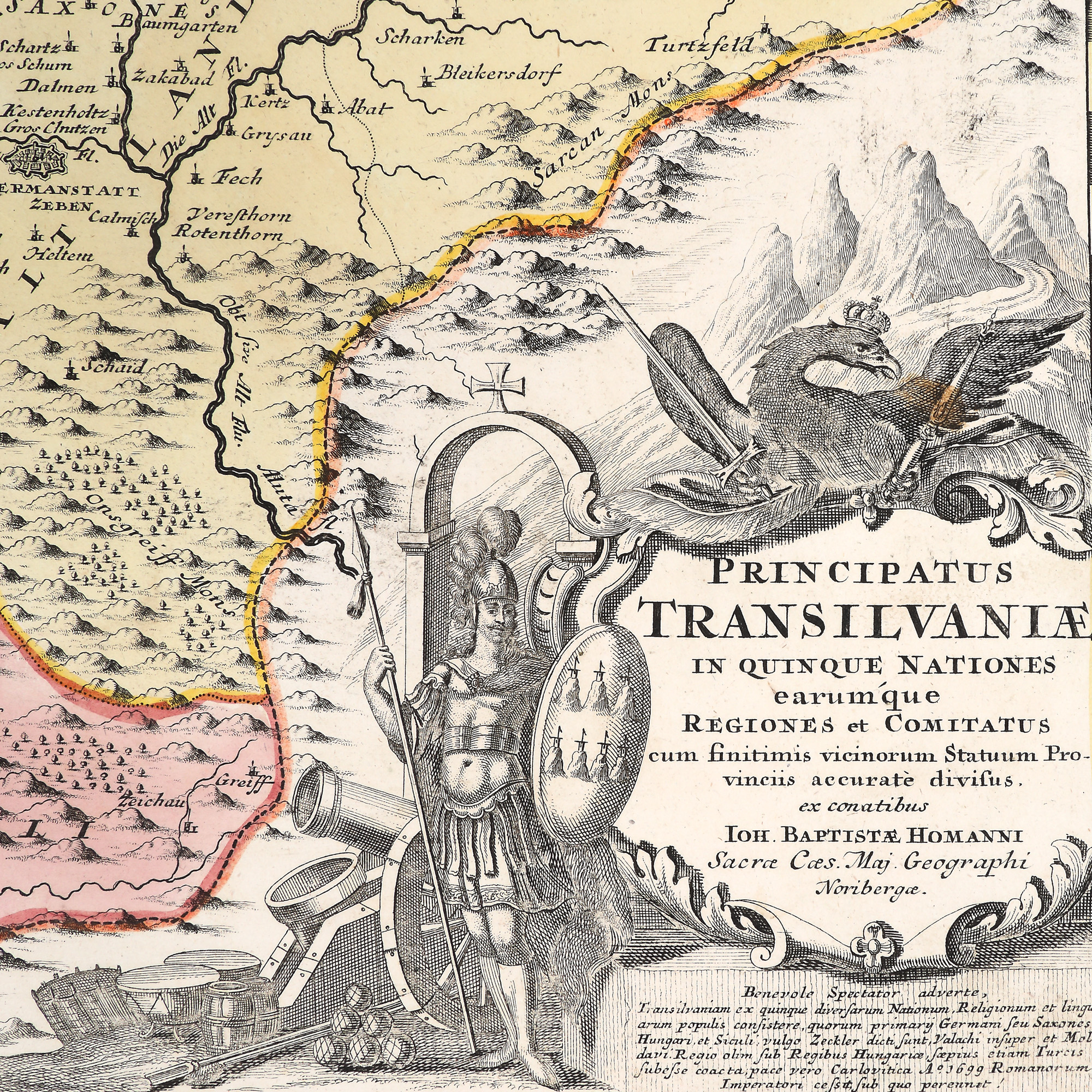
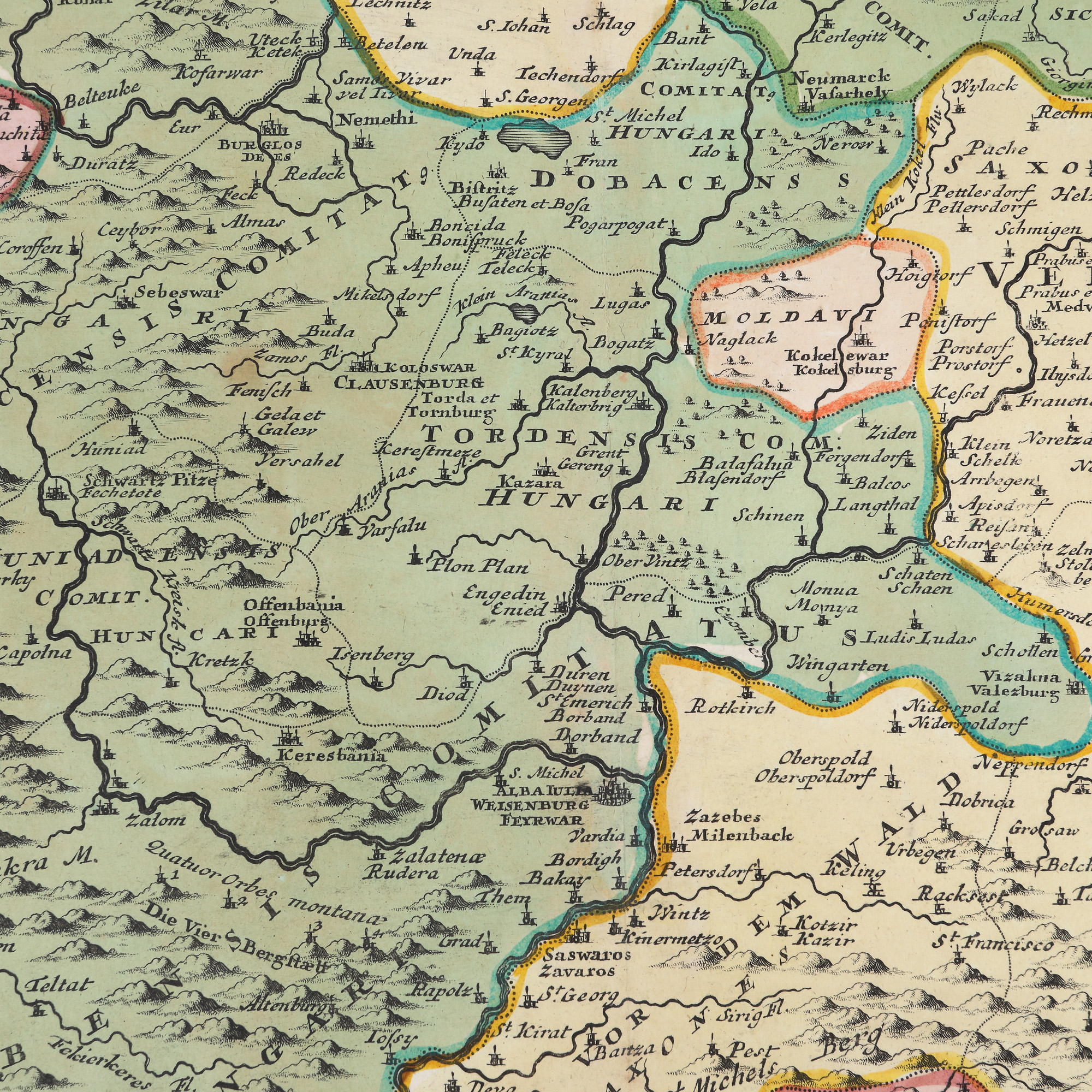
29. "Principatul Transilvania" ("Principality of Transylvania") map, by Johann Baptist Homann, Nuremberg, 1699, rare, collector’s item
Starting price
EUR 300
Sold
EUR 500
Session
Thu, 17 November 2022 19:00
Dimensions
width 63 cm, height 52 cm, custom 52 Ã 63 cm
Description
hand-coloured copper engraving, striped paper
ADDITIONAL INFORMATION
For clarifications regarding the bidding procedure, hammer price costs, guarantee, payment, and collection terms for the winning lot, we recommend carefully reading/re-reading the Bidding Regulations.
For additional information regarding the lot and the auction, please contact the Art Consultants Department.
Detalii
ADDITIONAL INFORMATION
For clarifications regarding the bidding procedure, hammer price costs, guarantee, payment, and collection terms for the winning lot, we recommend carefully reading/re-reading the Bidding Regulations.
For additional information regarding the lot and the auction, please contact the Art Consultants Department.
Dimensions
width 63 cm, height 52 cm, custom 52 Ã 63 cm
Description
hand-coloured copper engraving, striped paper
Similar lots
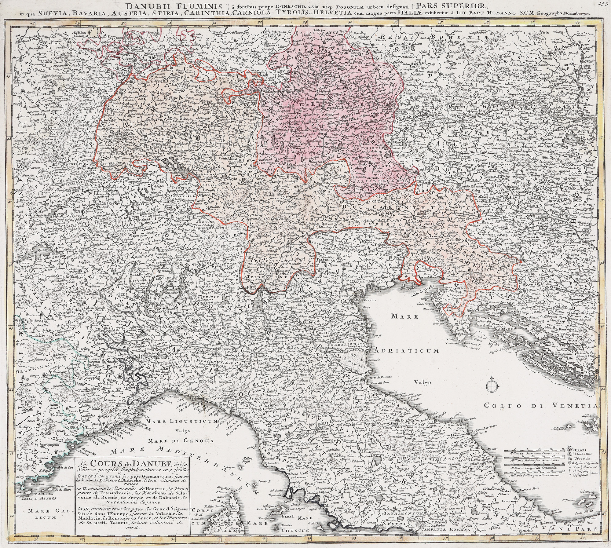
26. "Dunărea - cursul inferior" ("Danube – lower course") map, by Johann Baptist Homann, Nuremberg, ca. 1720, collector’s item
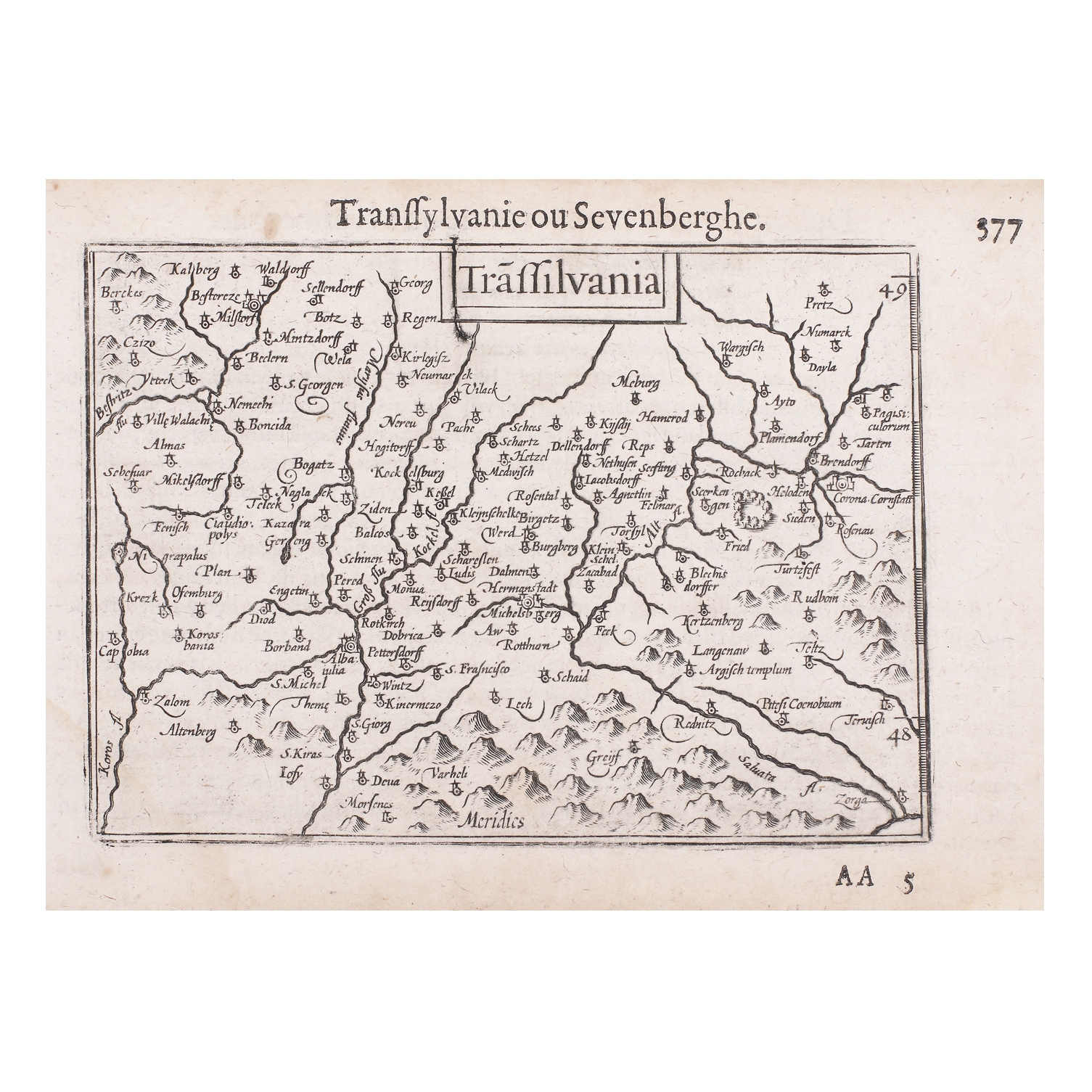
28. "Transilvania" ("Transylvania") map, by Barent Langenes, Amsterdam, 1609