The photos of the lot are informative and indicative, and cannot provide a highly detailed view of the object from all angles. We recommend a careful physical inspection of the lot before bidding.
The photos of the lot are informative and indicative, and cannot provide a highly detailed view of the object from all angles. We recommend a careful physical inspection of the lot before bidding.
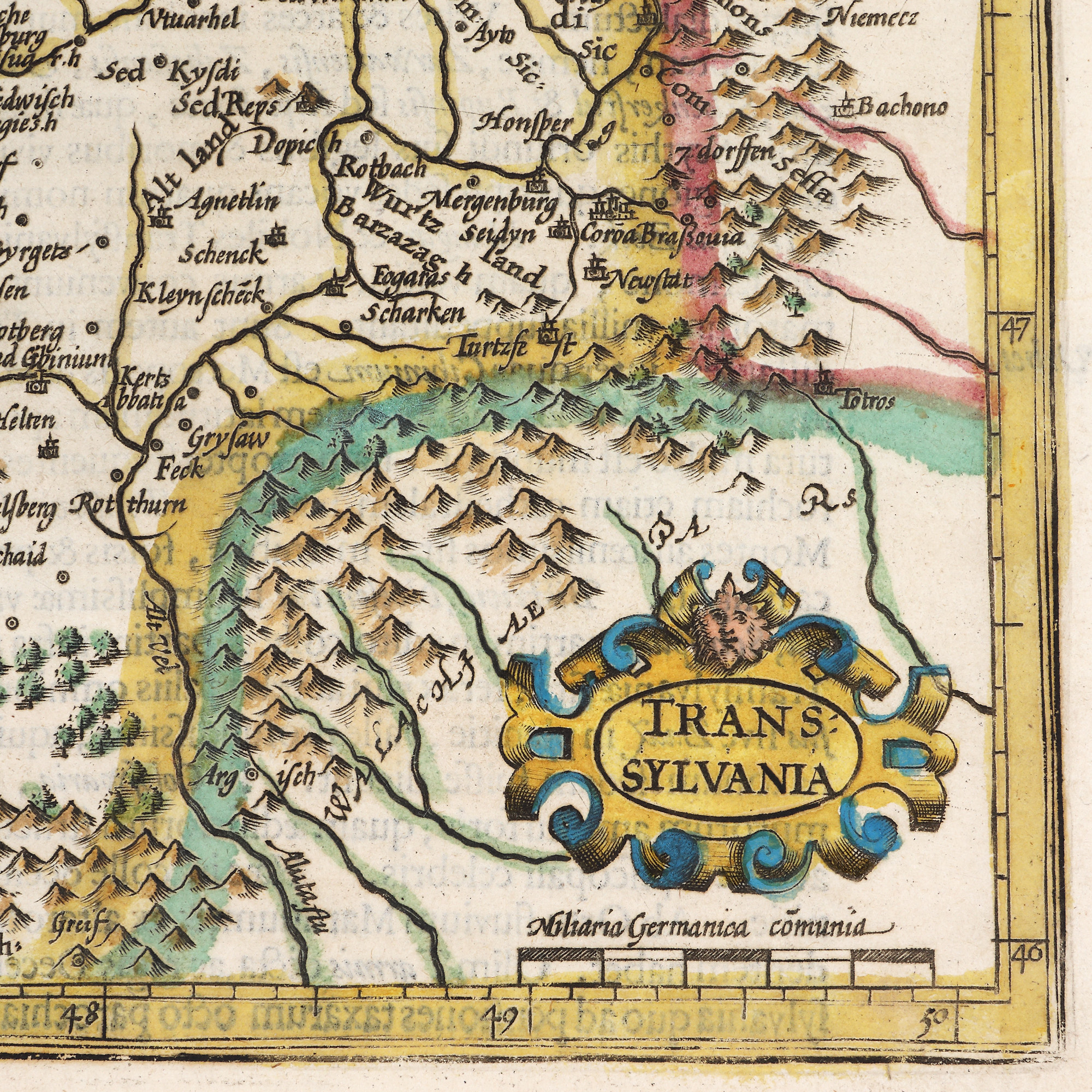
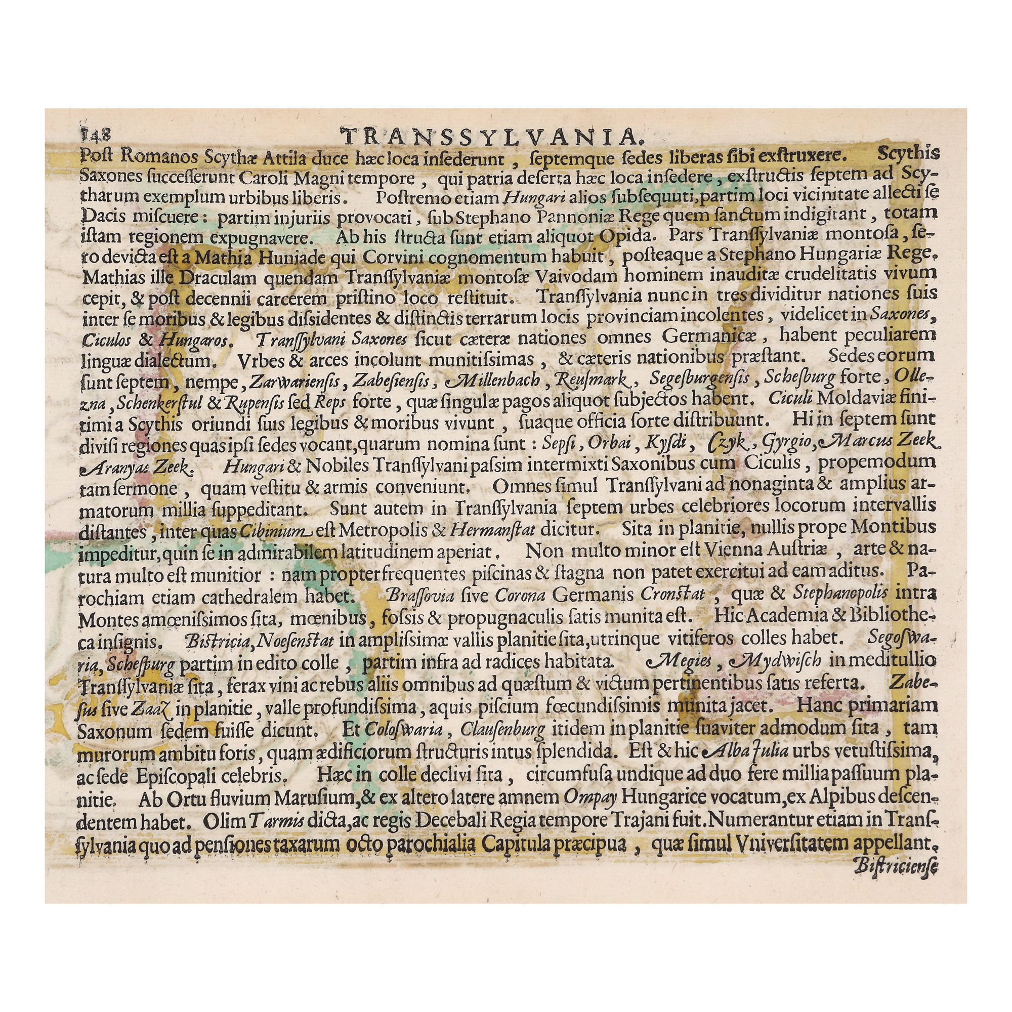
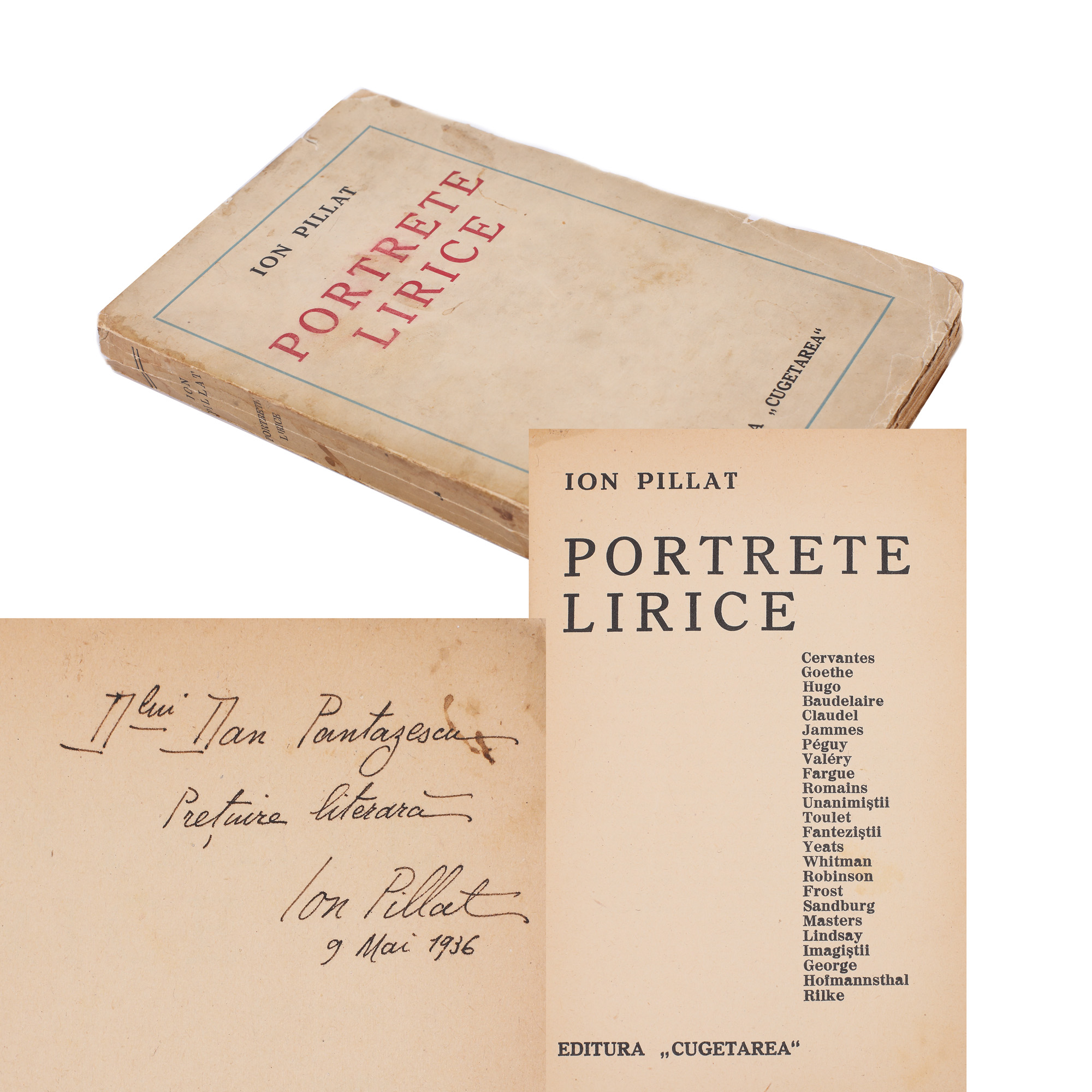
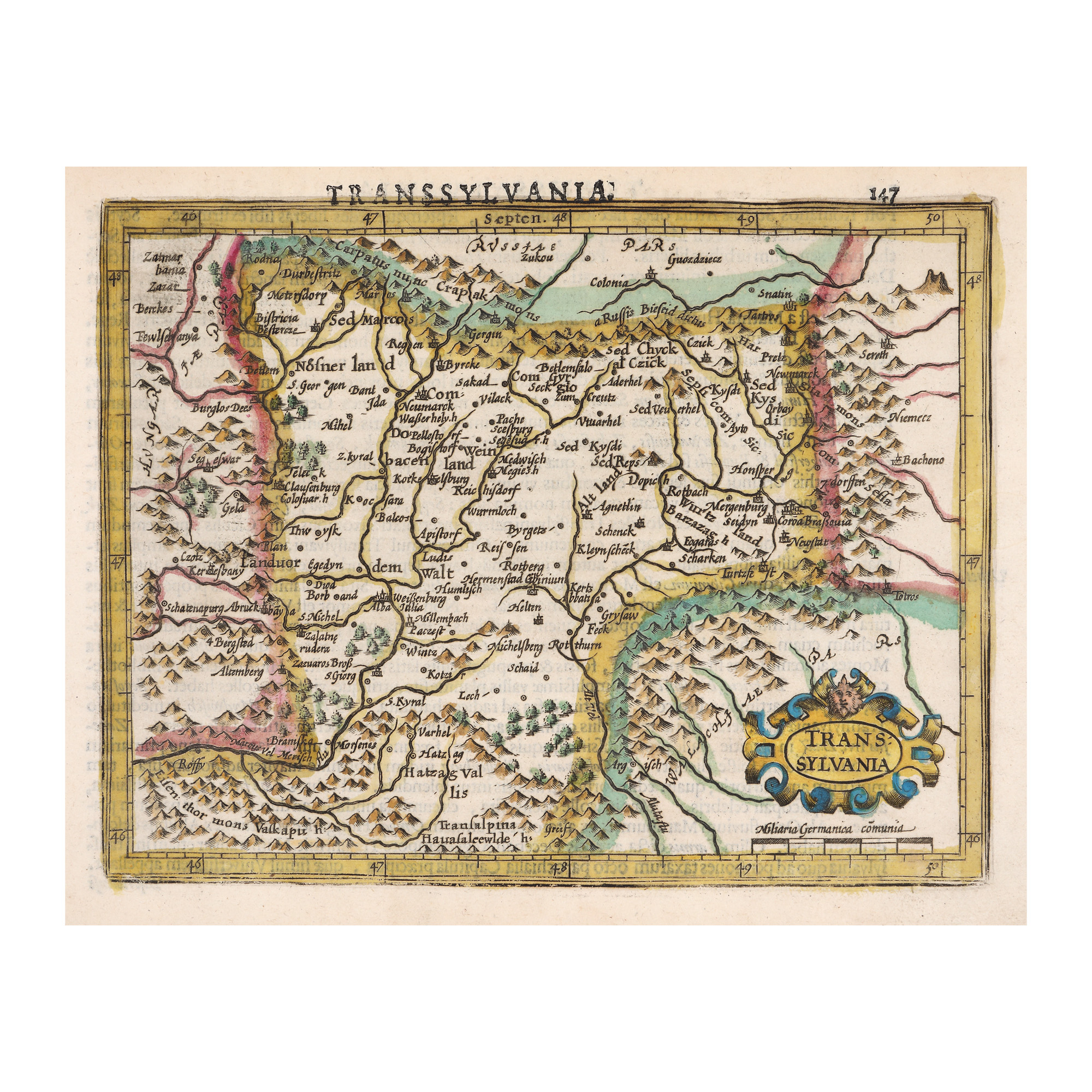
30. "Transilvania" ("Transylvania") map, by Gerardus Mercator, edition from the 18th century
Starting price
Pretul de pornire si cel estimat nu sunt preturi de vanzare efective
EUR 150
Sold
Pretul de pornire si cel estimat nu sunt preturi de vanzare efective
EUR 175
Session
Thu, 17 November 2022 19:00
Brought to you by
The map is part of the famous Atlas first published by Flemish geographer Gerardus Mercator in the 16th century.
Dimensions
width 14 cm, height 18 cm, custom 18 Ã 14 cm
Description
hand-coloured copper engraving, striped paper
ADDITIONAL INFORMATION
For clarifications regarding the bidding procedure, hammer price costs, guarantee, payment, and collection terms for the winning lot, we recommend carefully reading/re-reading the Bidding Regulations.
For additional information regarding the lot and the auction, please contact the Art Consultants Department.
Detalii
The map is part of the famous Atlas first published by Flemish geographer Gerardus Mercator in the 16th century.
ADDITIONAL INFORMATION
For clarifications regarding the bidding procedure, hammer price costs, guarantee, payment, and collection terms for the winning lot, we recommend carefully reading/re-reading the Bidding Regulations.
For additional information regarding the lot and the auction, please contact the Art Consultants Department.
Dimensions
width 14 cm, height 18 cm, custom 18 Ã 14 cm
Description
hand-coloured copper engraving, striped paper
Brought to you by
Similar lots
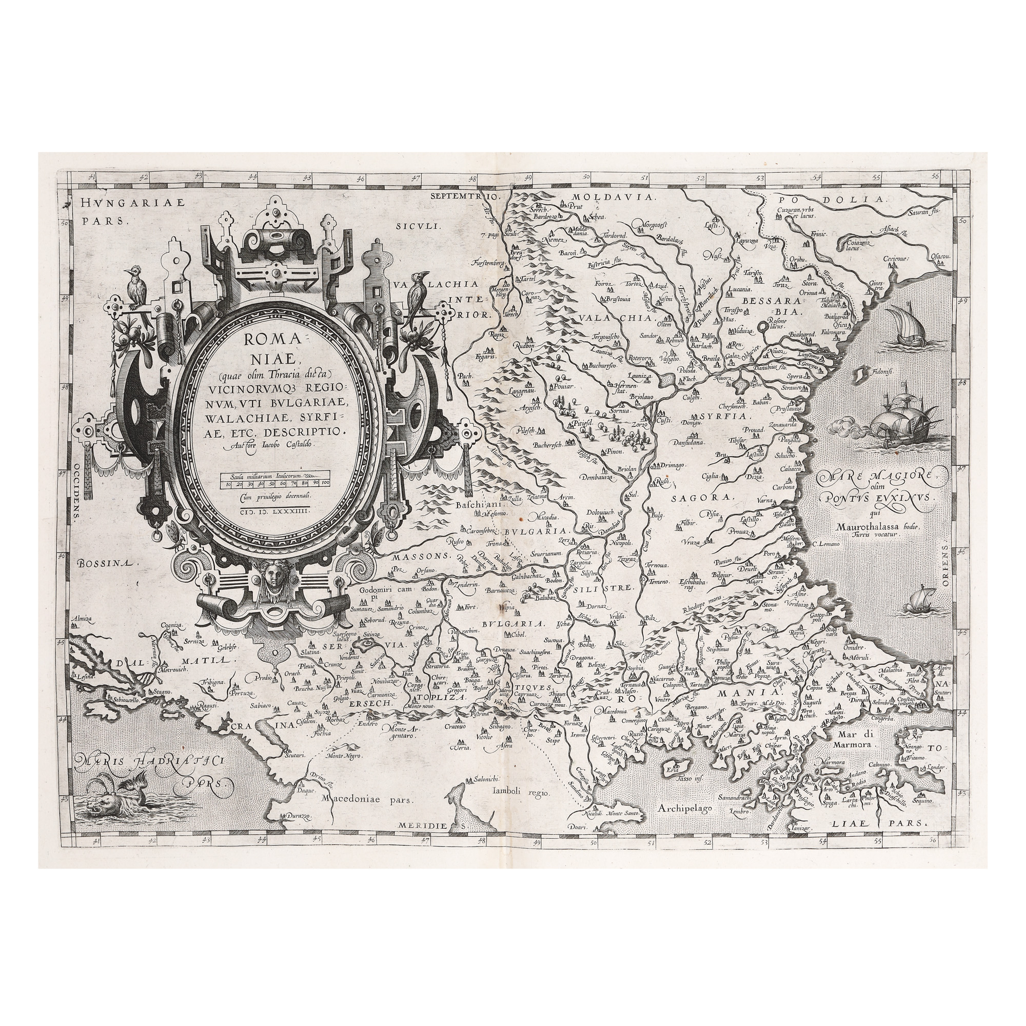
16. "Romaniae" map, by Iacobo Castaldo, printed by Abraham Ortelius, Orbis Terrarum edition, Antwerp, 1584
Starting price
EUR 250
Sold
EUR 1.200