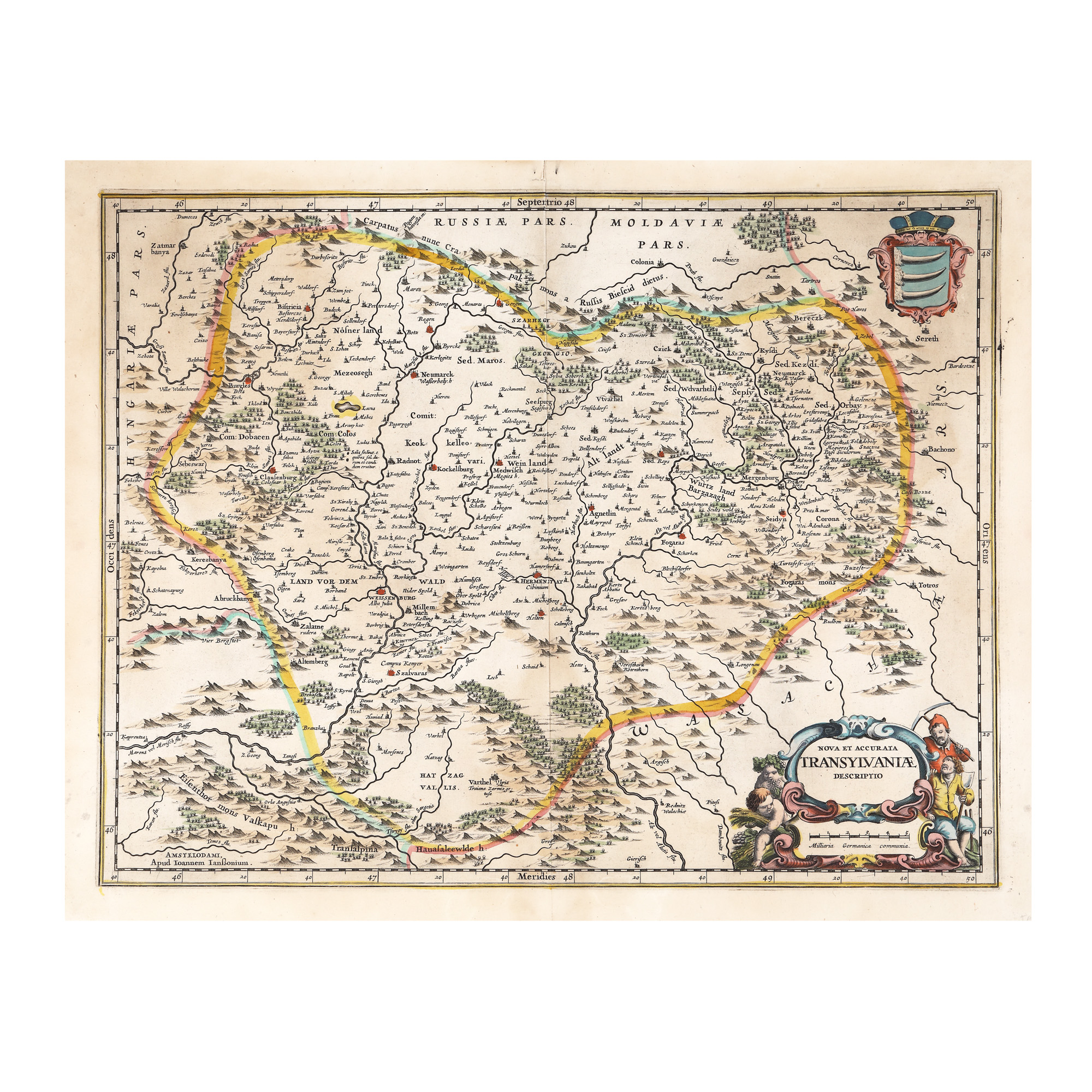
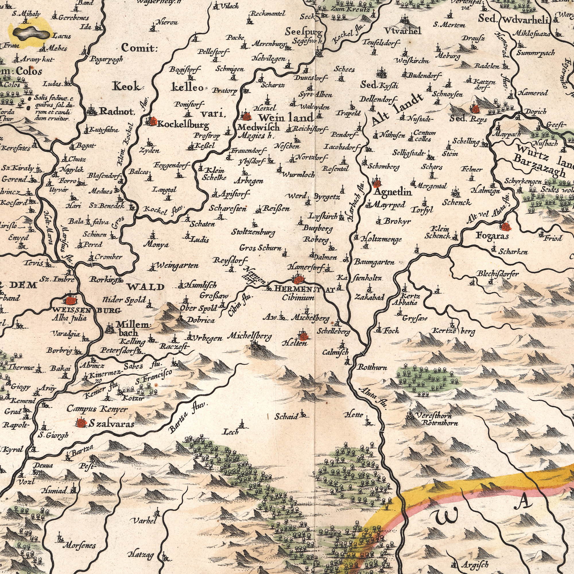
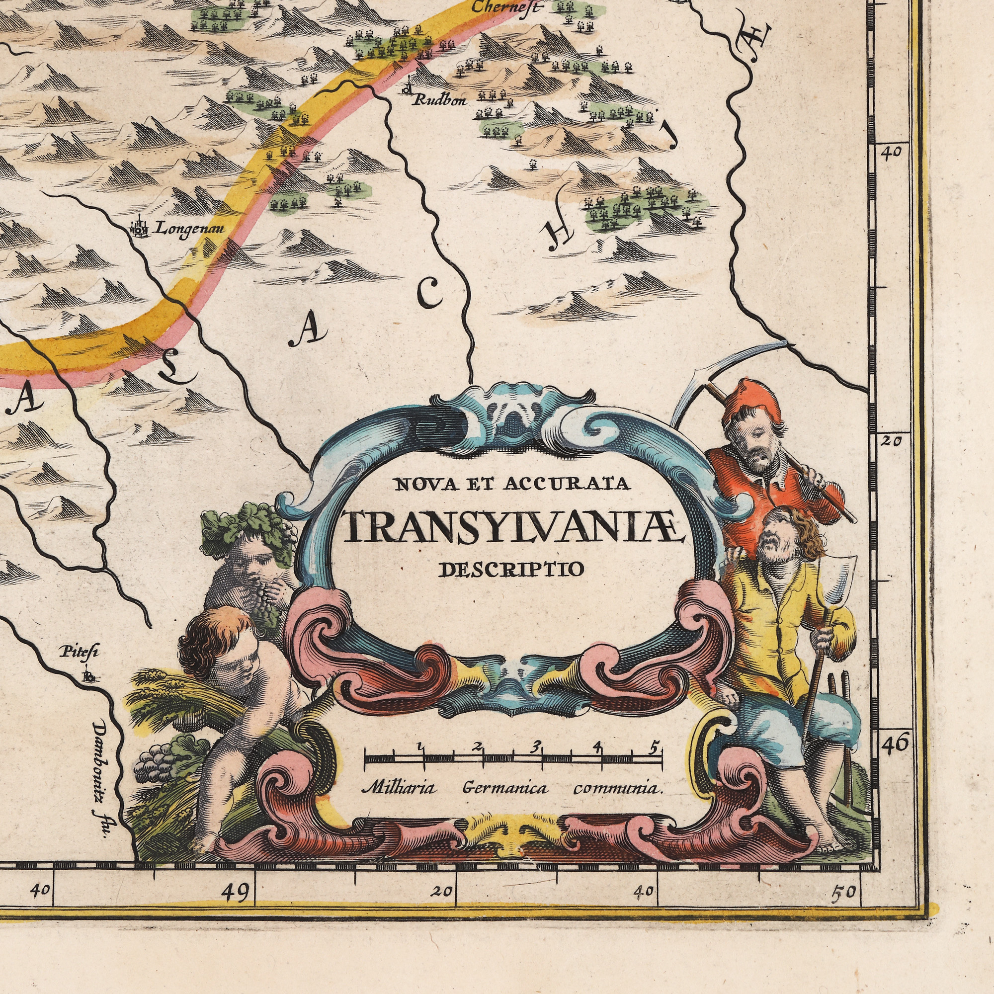
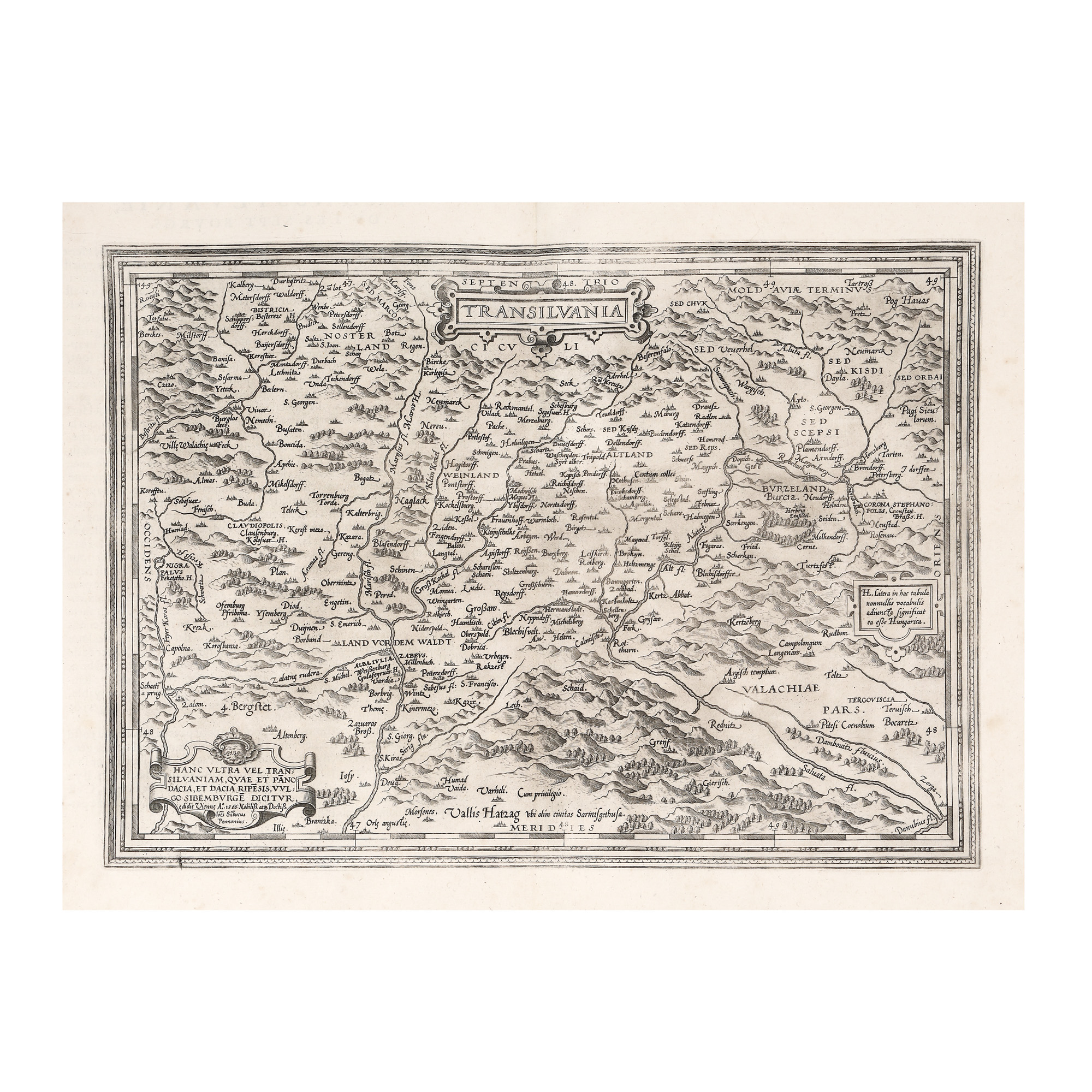
8. "Transilvania" ("Transylvania") map, by Jan Janssonius, Amsterdam, 1665, rare, collector’s item
Starting price
EUR 300
Sold
EUR 900
Session
Thu, 17 November 2022 19:00
Dimensions
width 57 cm, height 45 cm, custom 45 Ã 57 cm
Description
hand-coloured copper engraving, striped paper
ADDITIONAL INFORMATION
For clarifications regarding the bidding procedure, hammer price costs, guarantee, payment, and collection terms for the winning lot, we recommend carefully reading/re-reading the Bidding Regulations.
For additional information regarding the lot and the auction, please contact the Art Consultants Department.
Detalii
ADDITIONAL INFORMATION
For clarifications regarding the bidding procedure, hammer price costs, guarantee, payment, and collection terms for the winning lot, we recommend carefully reading/re-reading the Bidding Regulations.
For additional information regarding the lot and the auction, please contact the Art Consultants Department.
Dimensions
width 57 cm, height 45 cm, custom 45 Ã 57 cm
Description
hand-coloured copper engraving, striped paper
Similar lots
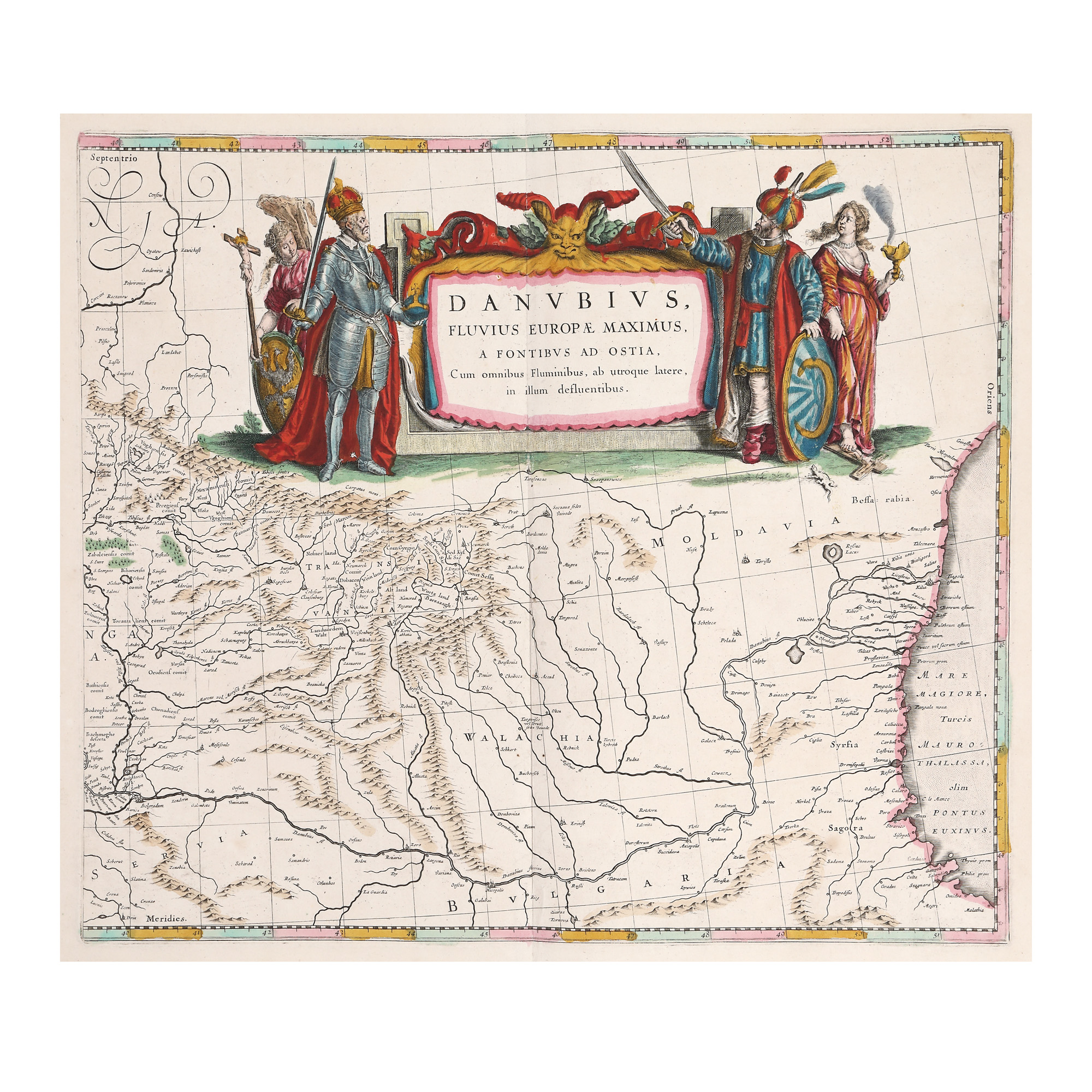
25. "Dunărea" ("Danube") map, by Willem Janszoon Blaeu, Amsterdam, 1635
3. "Transilvania" ("Transylvania") map, by Johannes Sambucus (Janos Zsamboky), printed by Abraham Ortelius, Orbis Terrarum edition, 1566
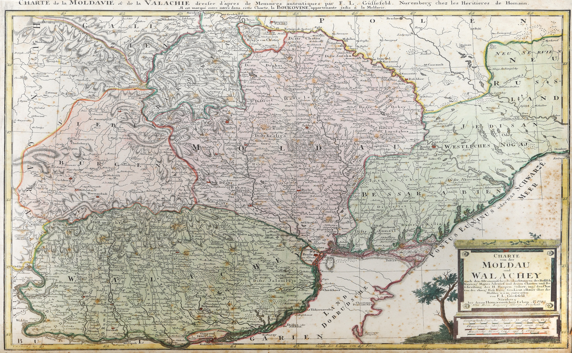
14. "Moldova și Valahia" ("Moldova and Wallachia") map, by Franz Ludwig Güssefeld, Nuremberg, 1785