


The photos of the lot are informative and indicative, and cannot provide a highly detailed view of the object from all angles. We recommend a careful physical inspection of the lot before bidding.
The photos of the lot are informative and indicative, and cannot provide a highly detailed view of the object from all angles. We recommend a careful physical inspection of the lot before bidding.
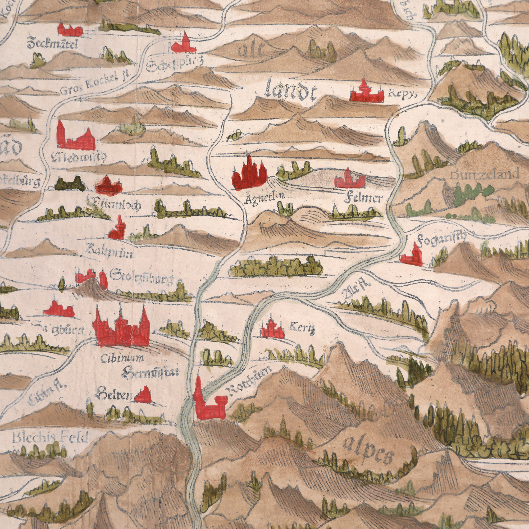
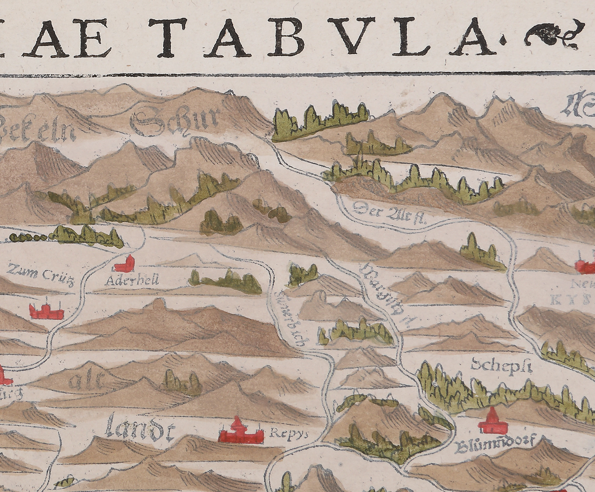
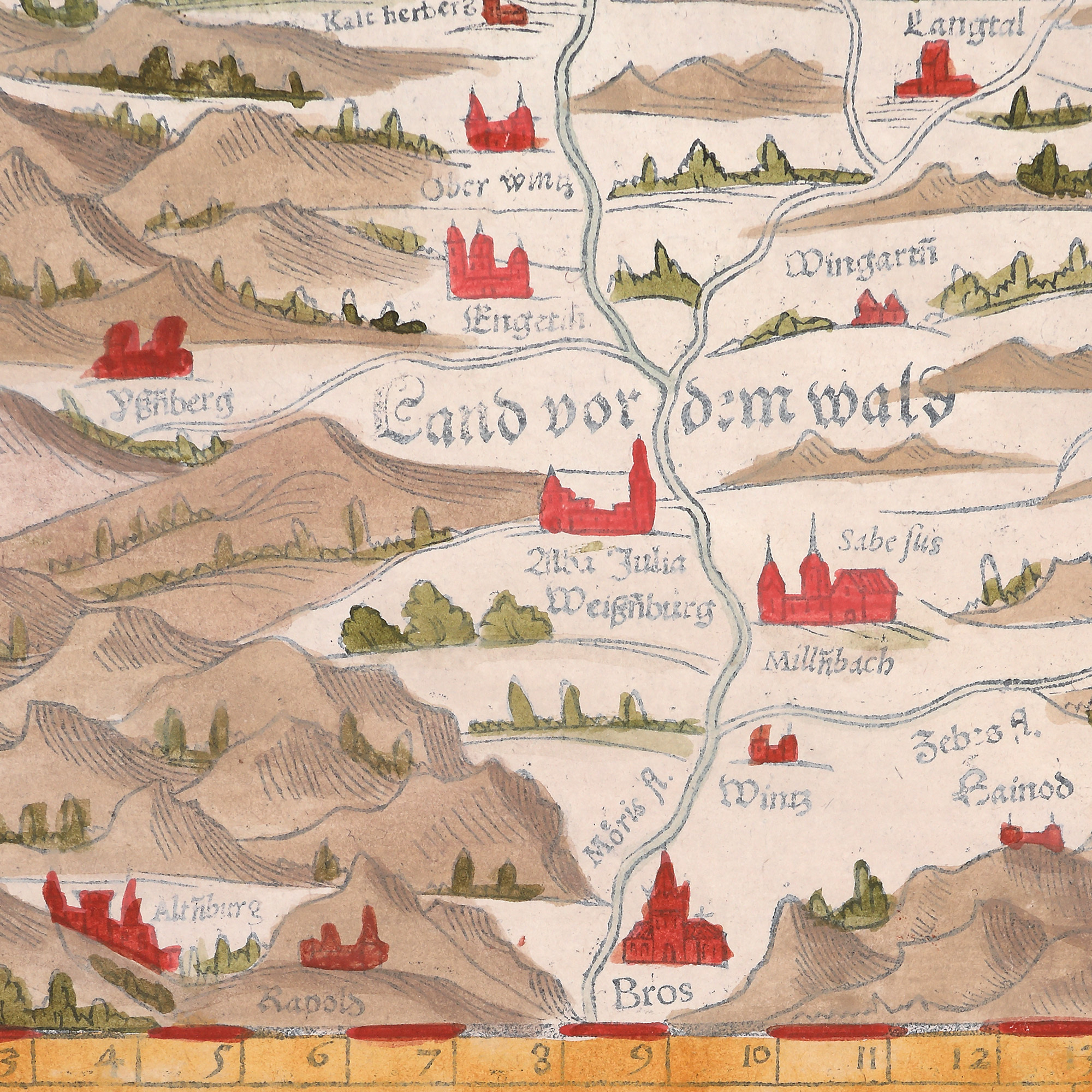
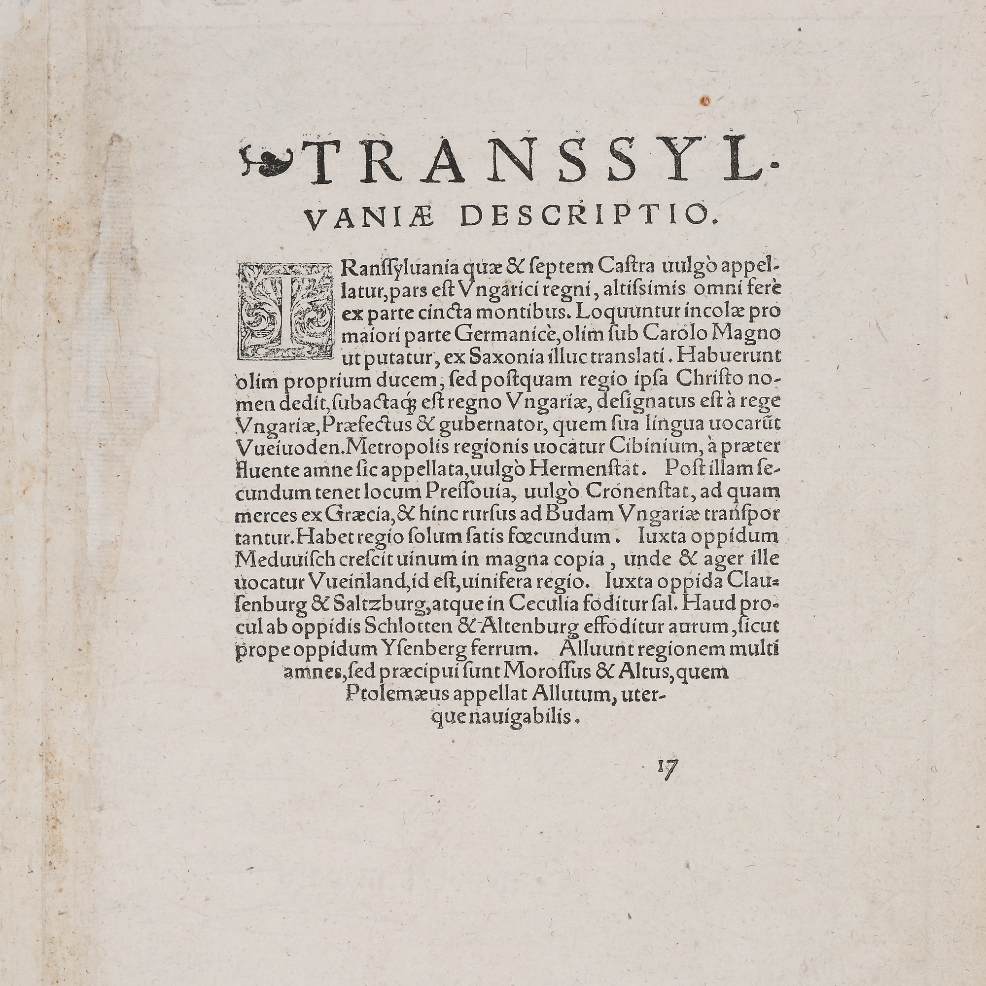
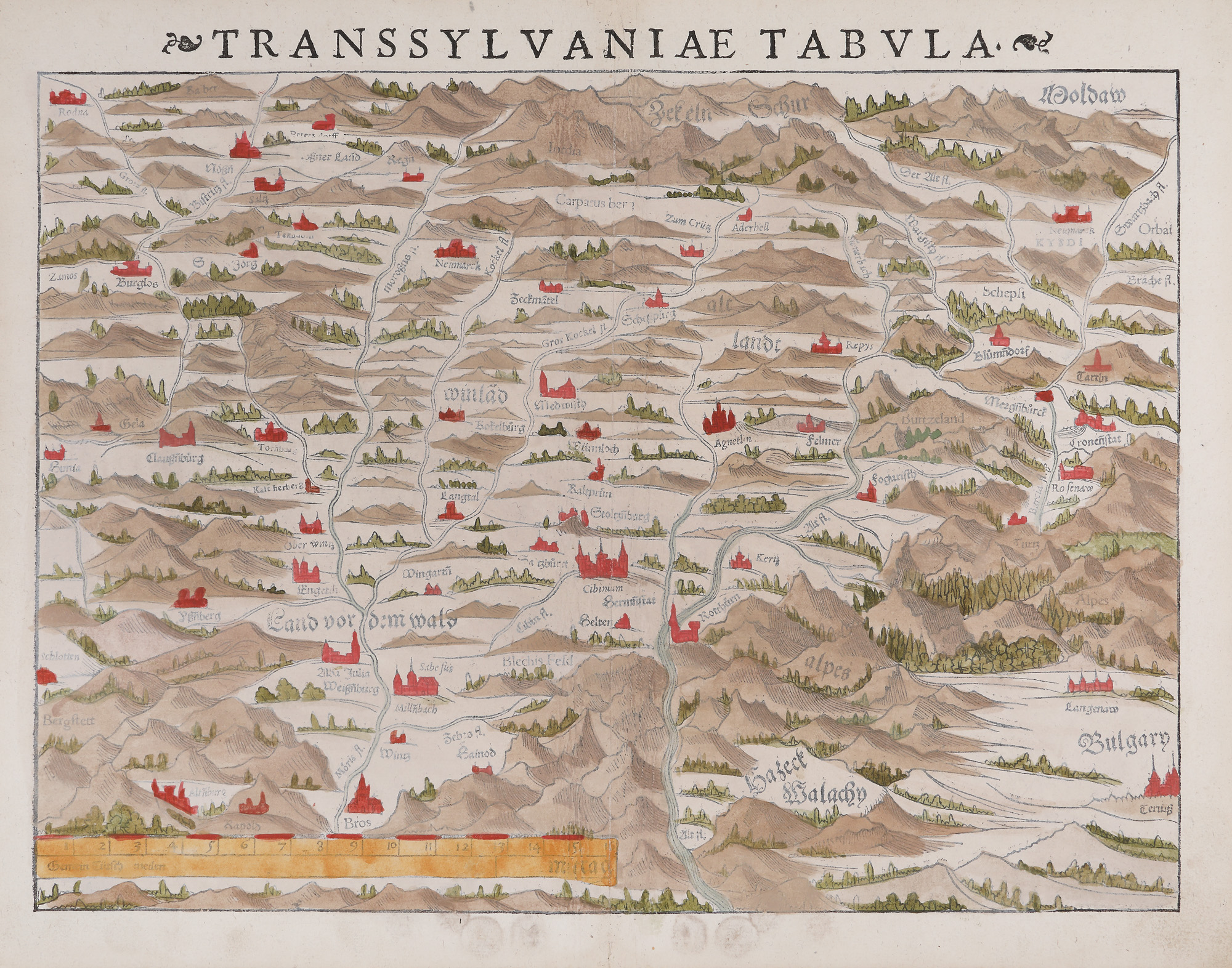
4. "Transilvania" ("Transylvania") map, by Sebastian Münster, Basel, 1572
Starting price
Pretul de pornire si cel estimat nu sunt preturi de vanzare efective
EUR 350
Sold
Pretul de pornire si cel estimat nu sunt preturi de vanzare efective
EUR 900
Session
Thu, 17 November 2022 19:00
Brought to you by
Map of Transylvania and adjacent regions, inspired by the work of humanist Transylvania Saxon Johannes Honterus in 1532. Since 1544, it has been published in "Cosmographia Universalis" (Universalis Cosmography) and published in numerous editions. This German-language map is part of an edition published after 1572. On the upper right side, one can see Moldaw, on the lower side, Hatzeck Walachien, and in the lower register, on the right, Bulgarien is mentioned. The joining of Hațeg and Wallachia can be explained by means of ethnic criteria. The territory of Transylvania is represented within the Carpathian chain and is divided into five lands, mentioned in German: Winlad, Altlandt (Old Country), Burtzeland (Bârsei Country), Land vom dem Wald (The land before the forest) and Zekeln Schur. External borders with neighbouring countries and between component regions are not drawn. The localities of Alba Iulia/Weisnburg, Bras, Sabesus, Millnbach, Hermanstat, Cibinum, Rotthurn (Turnul Roșu), Fogaristh, Agnetlin, Felmer, Repys Terz, Rosenow, Cronstat (Brașov), Neumarck/Kysai are mentioned, many of them marked with miniature fortresses.
Dimensions
width 38 cm, height 30 cm, custom 30 Ã 38 cm
Description
hand-coloured copper engraving, striped paper
ADDITIONAL INFORMATION
For clarifications regarding the bidding procedure, hammer price costs, guarantee, payment, and collection terms for the winning lot, we recommend carefully reading/re-reading the Bidding Regulations.
For additional information regarding the lot and the auction, please contact the Art Consultants Department.
Detalii
Map of Transylvania and adjacent regions, inspired by the work of humanist Transylvania Saxon Johannes Honterus in 1532. Since 1544, it has been published in "Cosmographia Universalis" (Universalis Cosmography) and published in numerous editions. This German-language map is part of an edition published after 1572. On the upper right side, one can see Moldaw, on the lower side, Hatzeck Walachien, and in the lower register, on the right, Bulgarien is mentioned. The joining of Hațeg and Wallachia can be explained by means of ethnic criteria. The territory of Transylvania is represented within the Carpathian chain and is divided into five lands, mentioned in German: Winlad, Altlandt (Old Country), Burtzeland (Bârsei Country), Land vom dem Wald (The land before the forest) and Zekeln Schur. External borders with neighbouring countries and between component regions are not drawn. The localities of Alba Iulia/Weisnburg, Bras, Sabesus, Millnbach, Hermanstat, Cibinum, Rotthurn (Turnul Roșu), Fogaristh, Agnetlin, Felmer, Repys Terz, Rosenow, Cronstat (Brașov), Neumarck/Kysai are mentioned, many of them marked with miniature fortresses.
ADDITIONAL INFORMATION
For clarifications regarding the bidding procedure, hammer price costs, guarantee, payment, and collection terms for the winning lot, we recommend carefully reading/re-reading the Bidding Regulations.
For additional information regarding the lot and the auction, please contact the Art Consultants Department.
Dimensions
width 38 cm, height 30 cm, custom 30 Ã 38 cm
Description
hand-coloured copper engraving, striped paper
Brought to you by
Similar lots
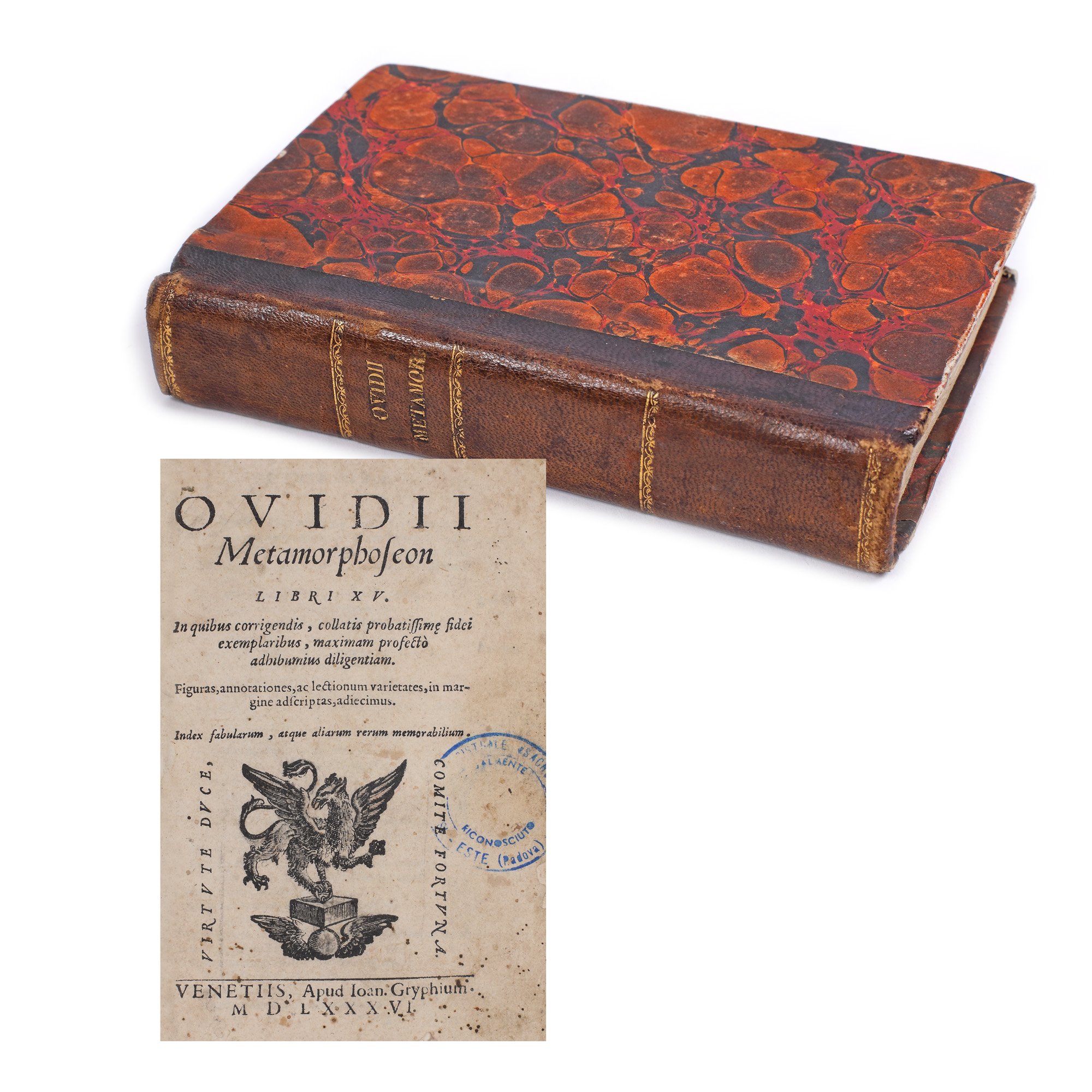
65. "Metamorfoze" ("Metamorphoses"), by Ovidius Publius Nasso, Latin, Venice, 1586
Starting price
EUR 350
Sold
EUR 350
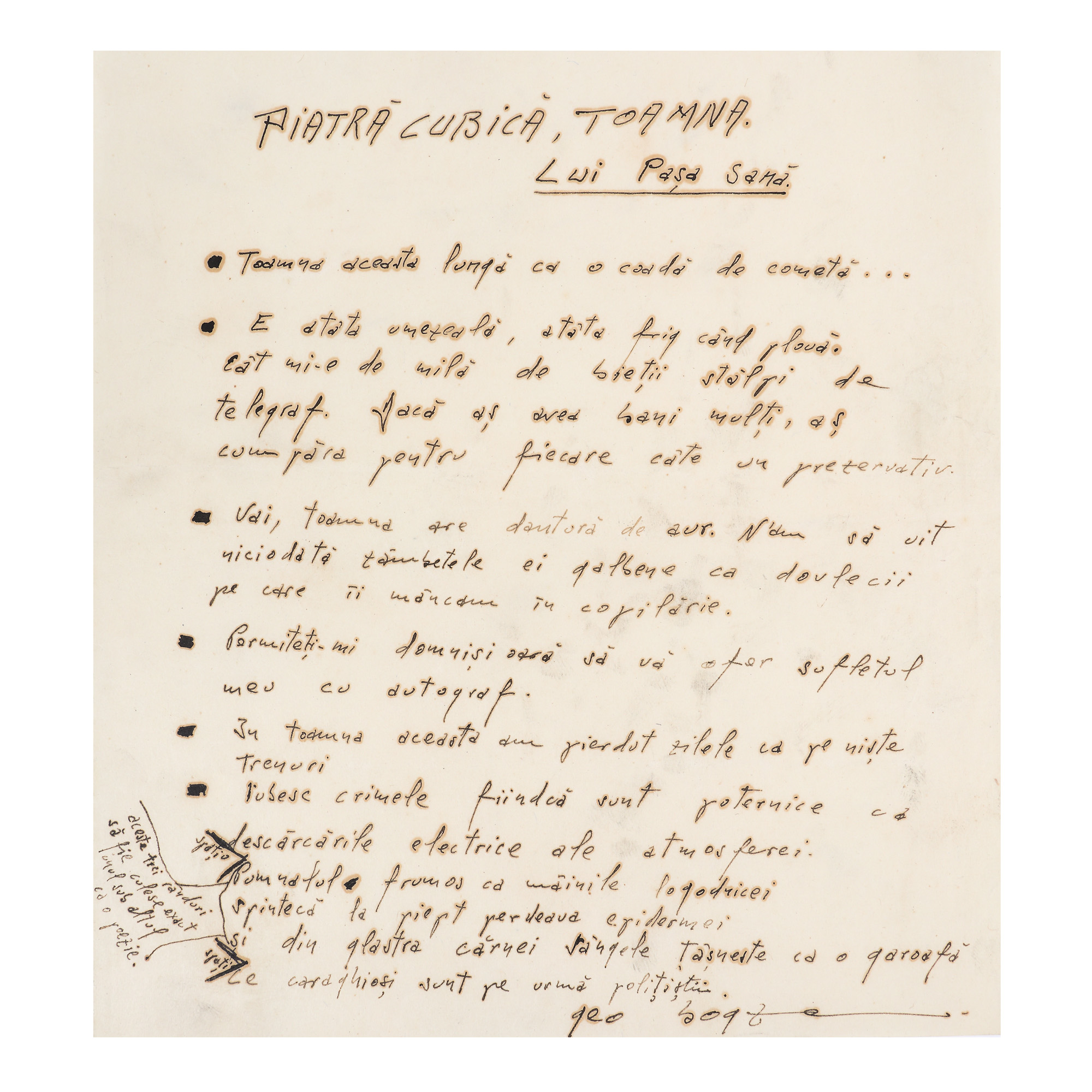
213. Manuscript entitled "Piatră cubică, toamna - lui Pașa Sană" ("Cubic stone, autumn – Pașa Sană"), by Geo Bogza, with the dedication to Sașa Pană and handwritten signature, published in "UNU" magazine, no. 20, rare, comes from the collection of the avant-garde poet Sașa Pană
Starting price
EUR 100
Sold
EUR 275