


The photos of the lot are informative and indicative, and cannot provide a highly detailed view of the object from all angles. We recommend a careful physical inspection of the lot before bidding.
The photos of the lot are informative and indicative, and cannot provide a highly detailed view of the object from all angles. We recommend a careful physical inspection of the lot before bidding.
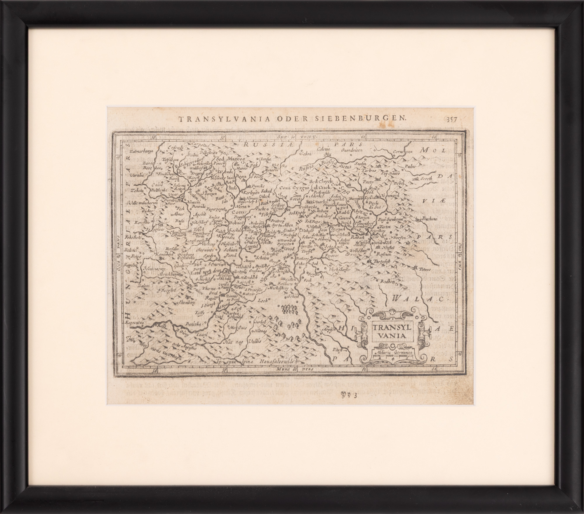
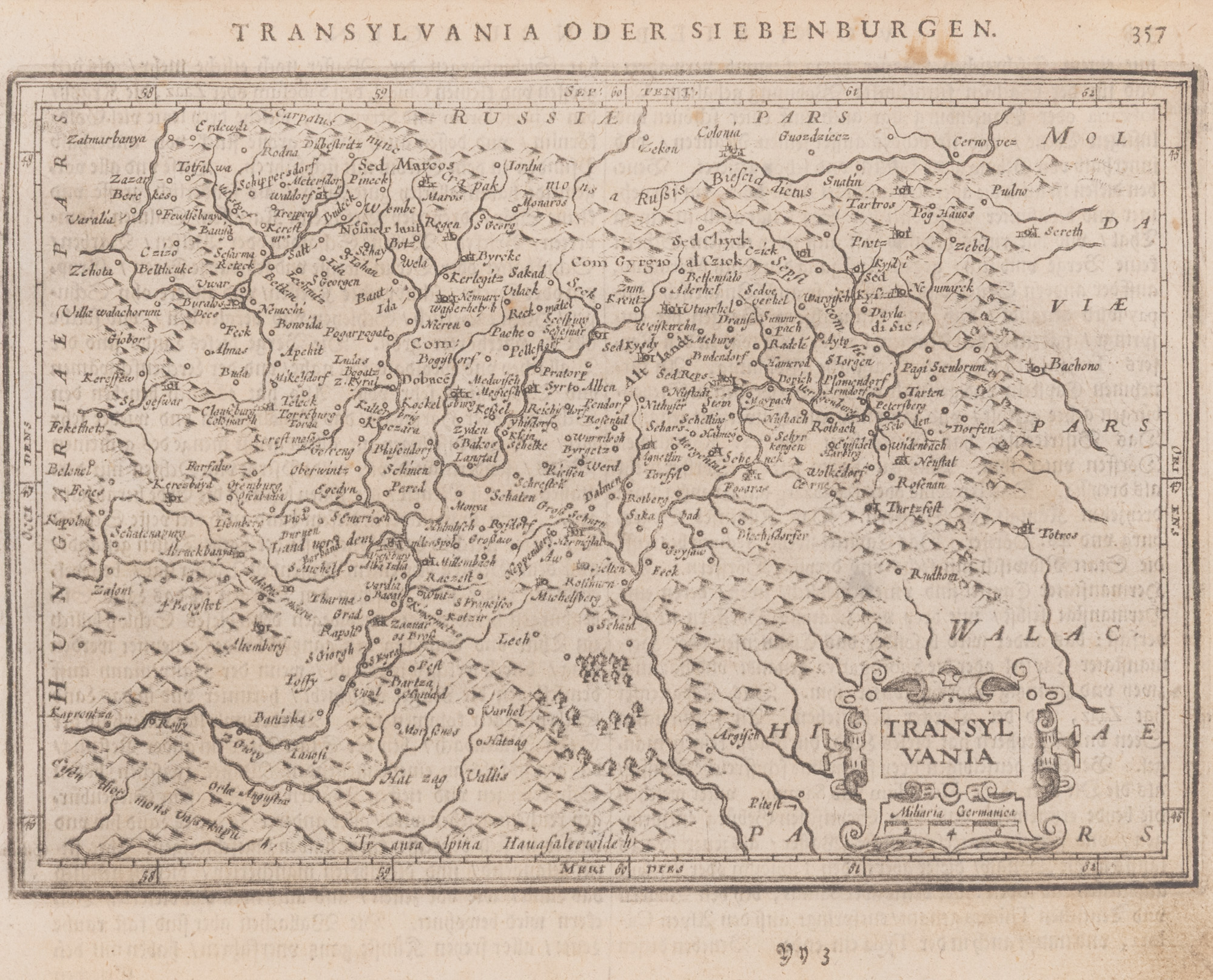
191. "Transylvania" Map by Jean Janssonius, Amsterdam, mid 18th century
Starting price
Pretul de pornire si cel estimat nu sunt preturi de vanzare efective
EUR 200
Session
Wed, 1 July 2026 19:00
0 Zile, 18 Ore, 37 Minute
Time remaining until live auction starts
Brought to you by
The Dutch cartographer Jan Janssonius (1588-1664) first published his work The New Atlas in Amsterdam in 1641. The atlas was a great success and was reprinted until the beginning of the 19th century in over 30 editions. The copy is part of a German language edition, probably from the middle of the 18th century. Copper engraving.
Dimensions
width 23 cm, height 18 cm
Description
copper engraving, marbled paper, 23.00x18.00
ADDITIONAL INFORMATION
For clarifications regarding the bidding procedure, hammer price costs, guarantee, payment, and collection terms for the winning lot, we recommend carefully reading/re-reading the Bidding Regulations.
For additional information regarding the lot and the auction, please contact the Art Consultants Department.
Detalii
The Dutch cartographer Jan Janssonius (1588-1664) first published his work The New Atlas in Amsterdam in 1641. The atlas was a great success and was reprinted until the beginning of the 19th century in over 30 editions. The copy is part of a German language edition, probably from the middle of the 18th century. Copper engraving.
ADDITIONAL INFORMATION
For clarifications regarding the bidding procedure, hammer price costs, guarantee, payment, and collection terms for the winning lot, we recommend carefully reading/re-reading the Bidding Regulations.
For additional information regarding the lot and the auction, please contact the Art Consultants Department.
Dimensions
width 23 cm, height 18 cm
Description
copper engraving, marbled paper, 23.00x18.00
Brought to you by
Similar lots
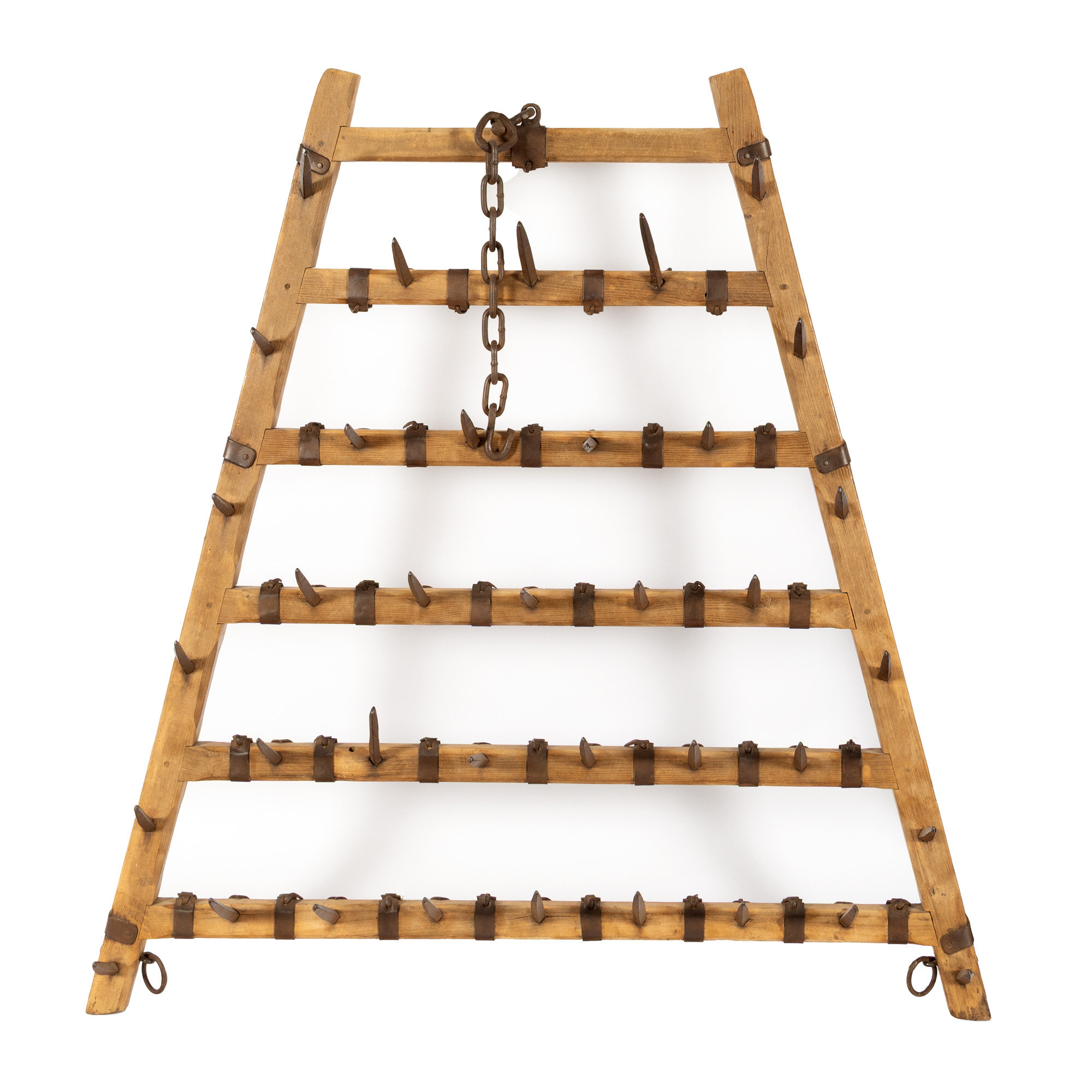
87. Oak wood harrow, with wrought iron teeth, 19th century, from the Grigore Ghyka collection
Starting price
EUR 200
0 Zile, 18 Ore, 37 Minute
Time remaining until live auction starts
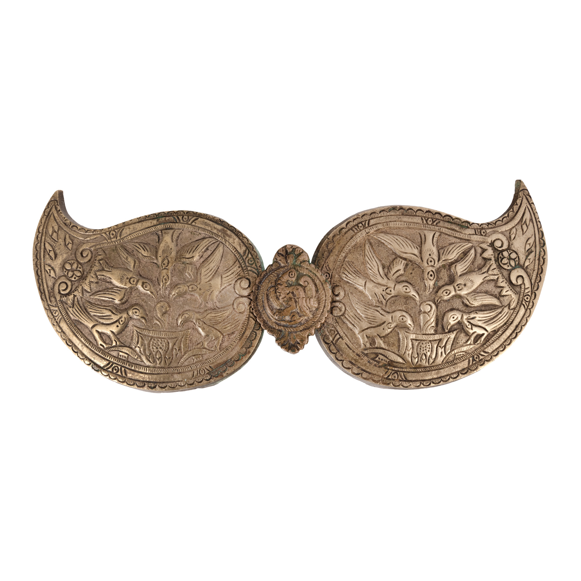
47. Silver plaque, decorated with doves, Balkan workshop, 19th century
Starting price
EUR 250
0 Zile, 18 Ore, 37 Minute
Time remaining until live auction starts
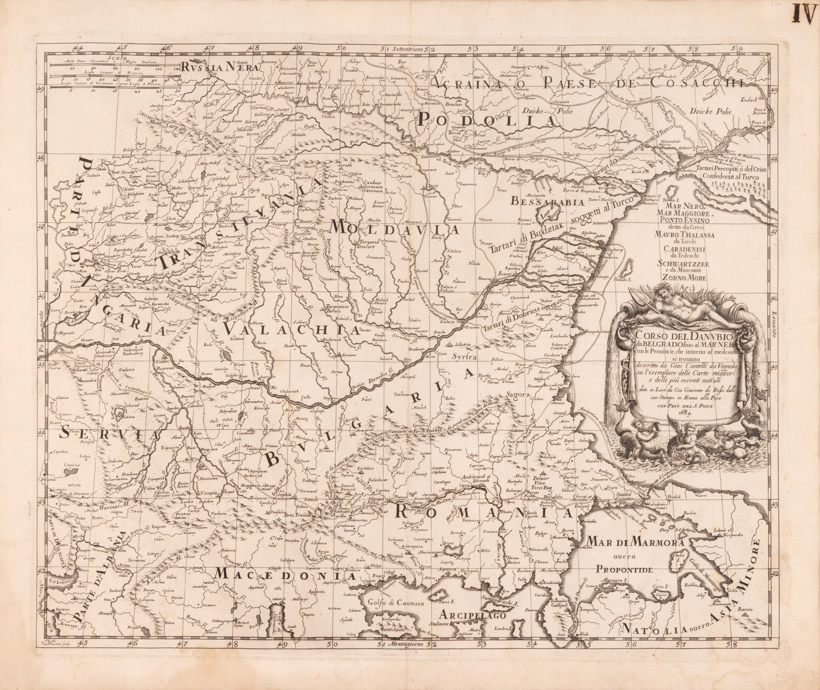
193. "Map of the Danube Course from Belgrade to the Black Sea", by Cantelli da Vignola, Rome, 1684
Starting price
EUR 300
0 Zile, 18 Ore, 37 Minute
Time remaining until live auction starts
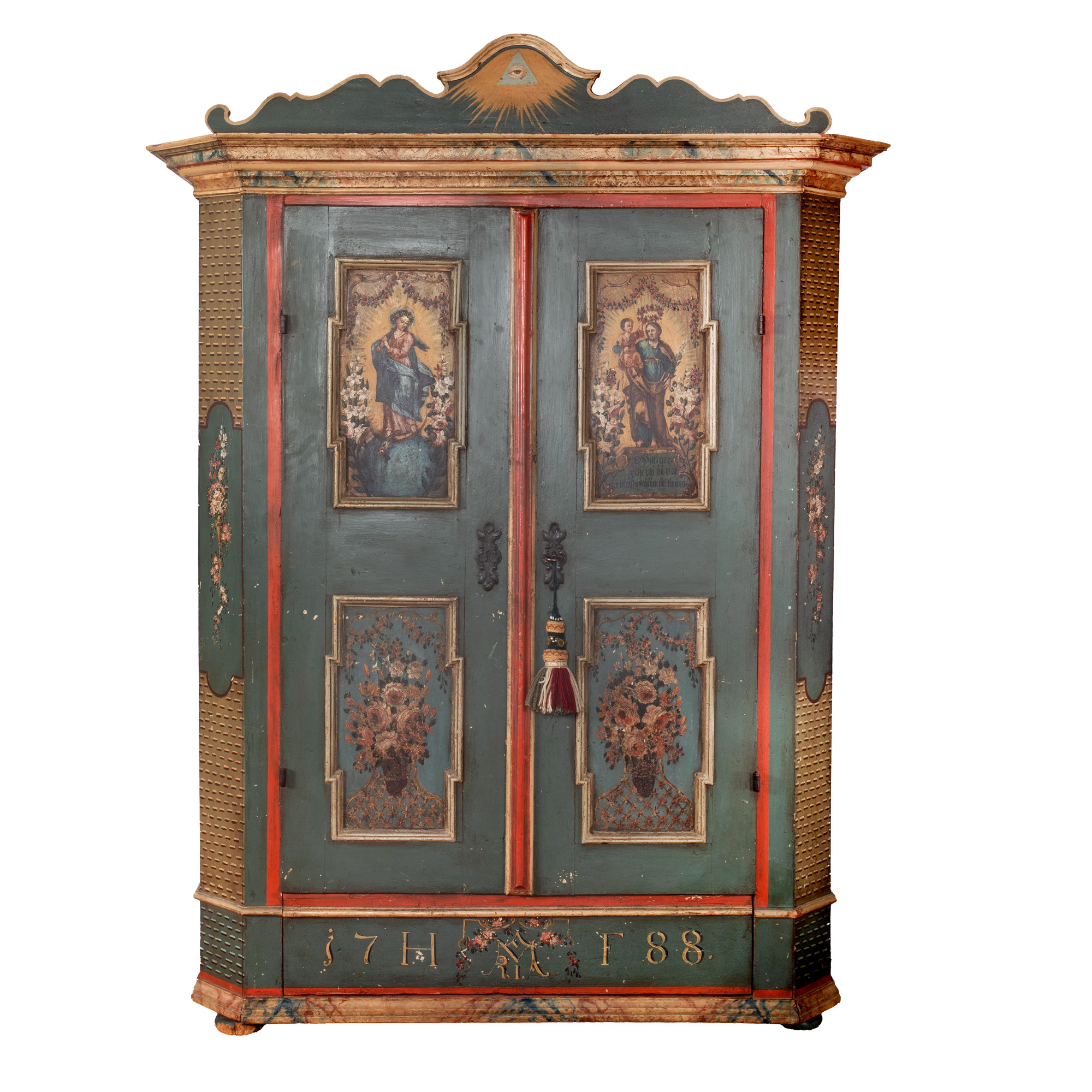
88. Impressive dowry cabinet, Habsburg Empire, dated 1788
Starting price
EUR 900
0 Zile, 18 Ore, 37 Minute
Time remaining until live auction starts