Meniu

Buying
How to sell
Contact
English
Gifts
Reduced Twice

Rare Books, Documents, Photography & Posters

Collectible Religious Art

Asian Art, Technical Objects, Taxidermy, Curiosities & Antiques

Jewelry & Watches

Numismatics, Medals, Maps, Arms & Decorations

Luxury, Elegance, Collectible Cars & Beverages

Collectible Folk Art

Sneakers & Toys

Discover


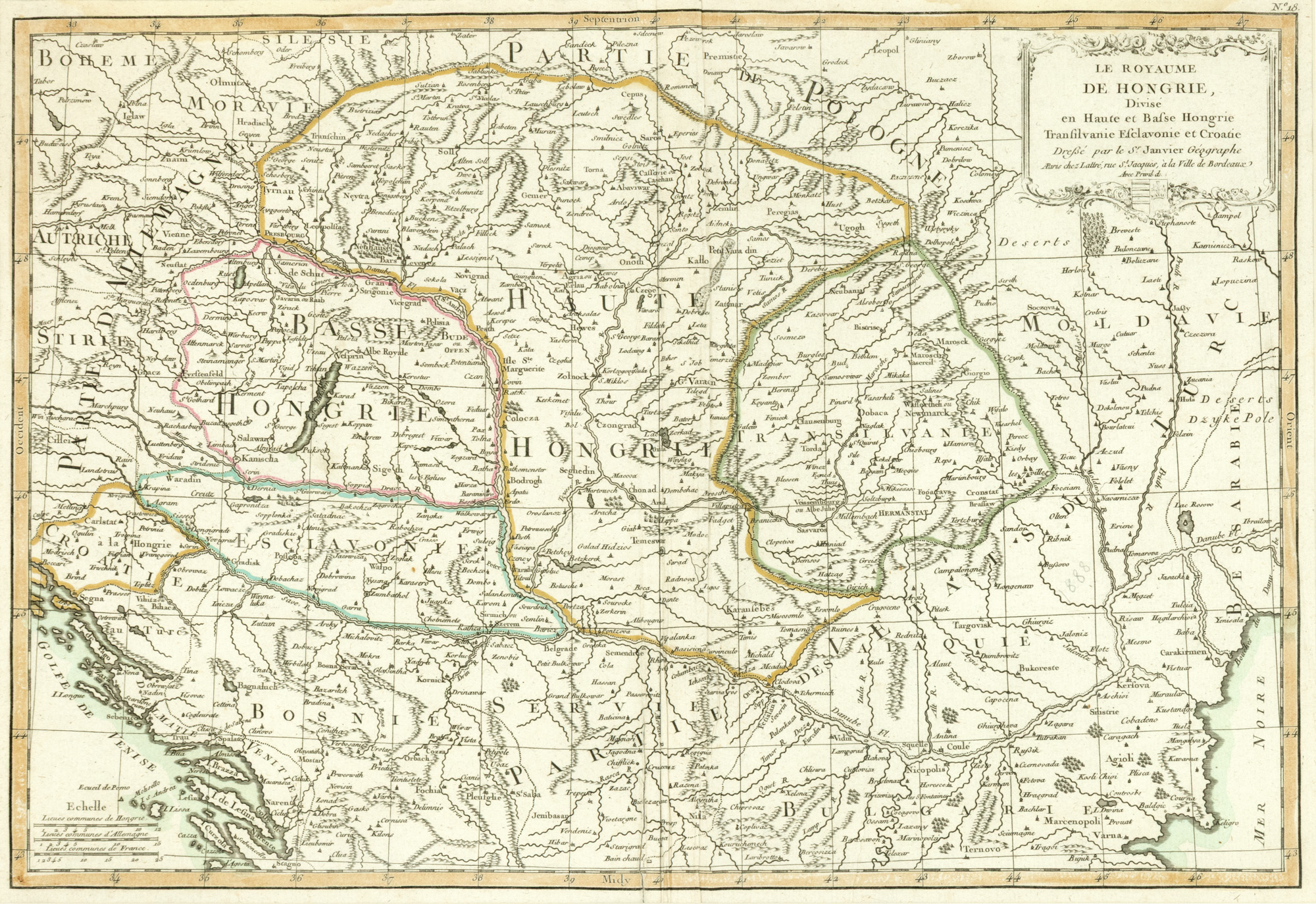
242. Map "Kingdom of Hungary divided into Upper and Lower Hungary, Transylvania, Slavonia and Croatia" by Jean Janvier, 1770

The photos of the lot are informative and indicative, and cannot provide a highly detailed view of the object from all angles. We recommend a careful physical inspection of the lot before bidding.

242. Map "Kingdom of Hungary divided into Upper and Lower Hungary, Transylvania, Slavonia and Croatia" by Jean Janvier, 1770


Starting price:
EUR 200
Sold
EUR 200

copper engraving, striated paper, hand colored, 36 x 51 cm

The French cartographer Jean Janvier (1746-1779) published in 1770 in Paris the work Atlas Moderne, which includes the piece in question. The map includes the northern and southern parts of Hungary, including Transylvania, as well as parts of Bosnia, Bulgaria, Moldova, and Wallachia. Specialists have not agreed on the first name of the scholar, he being mentioned either under the first name Jean, or Robert, this because he always signed his works as S(igno)r Janvier. Copper engraving manually colored after printing.

For clarifications regarding the bidding procedure, hammer price costs, guarantee, payment, and collection terms for the winning lot, we recommend carefully reading/re-reading the Bidding Regulations.

For additional information regarding the lot and the auction, please contact the Art Consultants Department.

SESSION
Tue, 29 September 2026, 12:00
Brought to you by

Similar lots