The photos of the lot are informative and indicative, and cannot provide a highly detailed view of the object from all angles. We recommend a careful physical inspection of the lot before bidding.
The photos of the lot are informative and indicative, and cannot provide a highly detailed view of the object from all angles. We recommend a careful physical inspection of the lot before bidding.
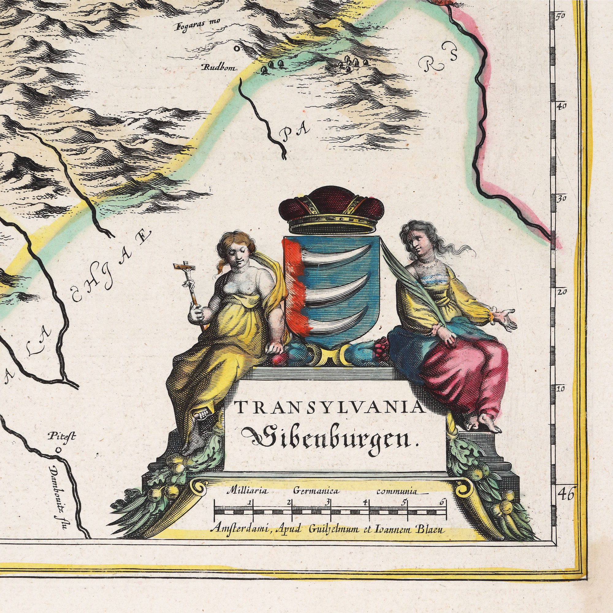
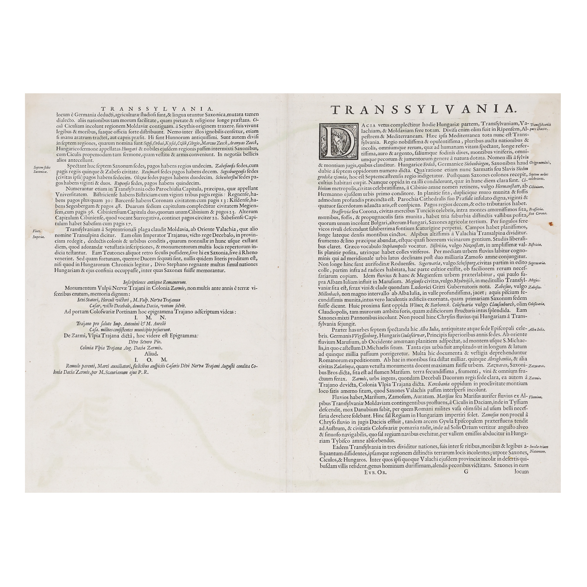
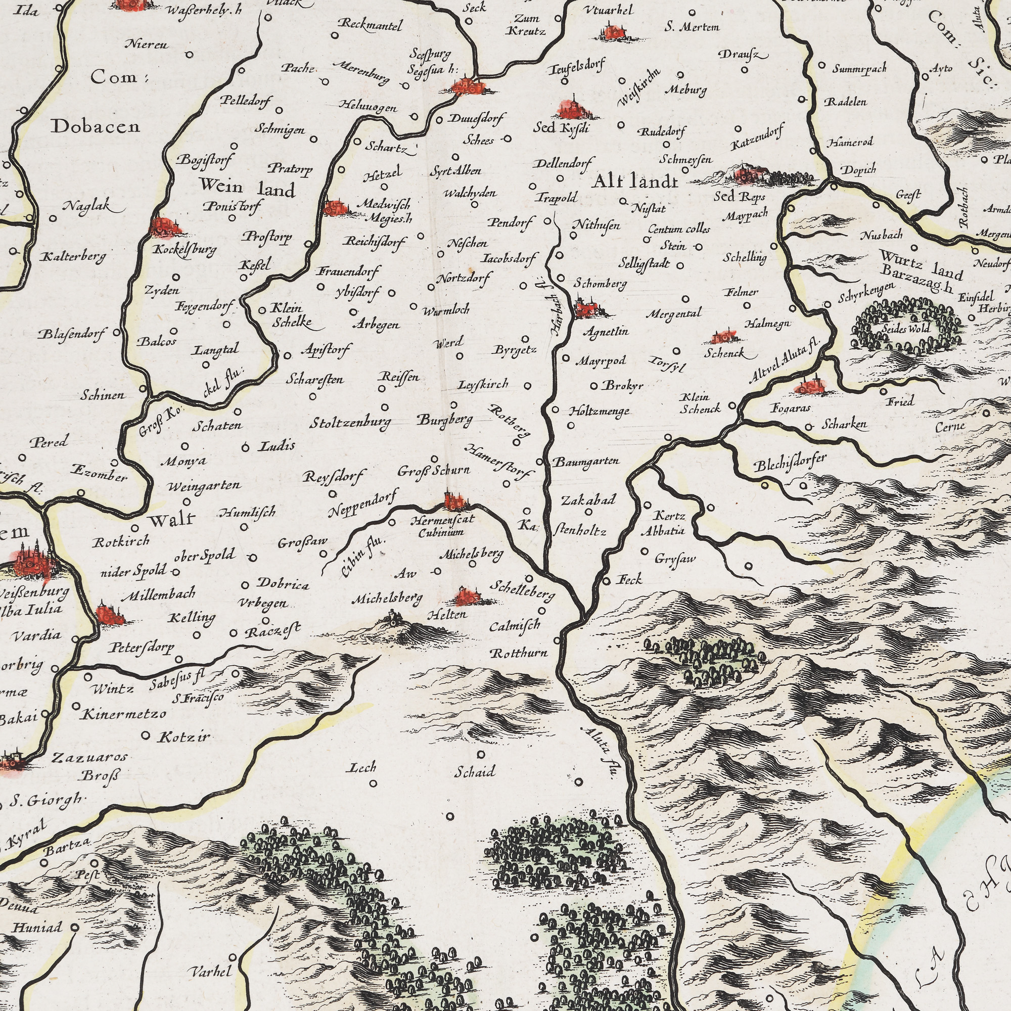
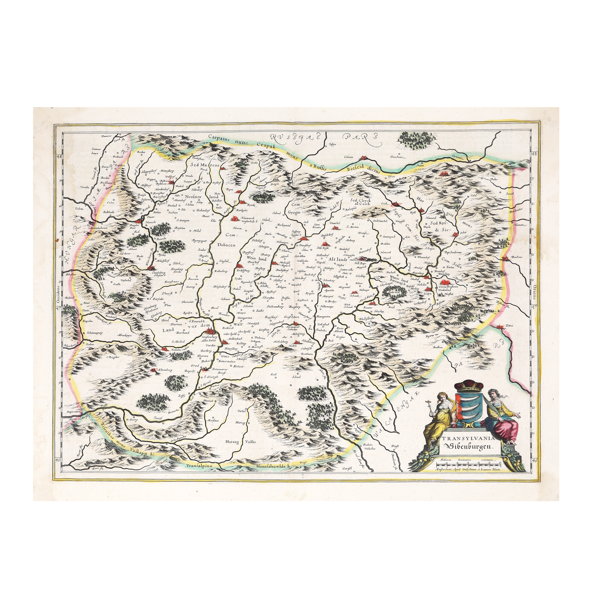
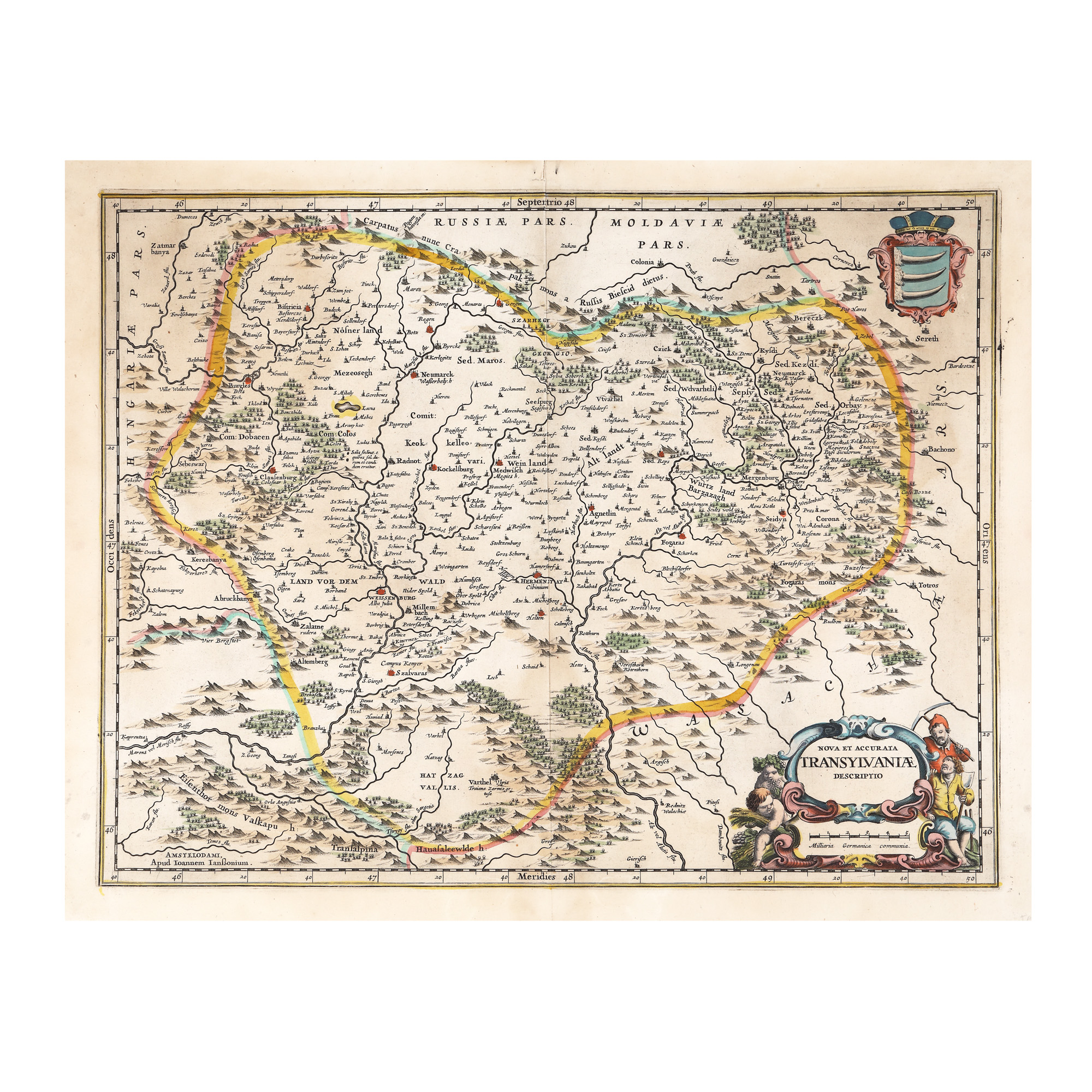
7. "Transilvania" ("Transylvania") map, by Willem Janszoon Blaeu, Amsterdam, 1634
Starting price
Pretul de pornire si cel estimat nu sunt preturi de vanzare efective
EUR 250
Sold
Pretul de pornire si cel estimat nu sunt preturi de vanzare efective
EUR 600
Session
Thu, 17 November 2022 19:00
Brought to you by
Map of Transylvania included in Atlas Major (appeared in several volumes) edited by the Bleau family in Amsterdam. As is known today (KEUNING 1959: 74), W. Blau acquired in 1629 a series of engraving plates from Mercator's collection from Jodocus Hondius Jr. Thus, with the exception of the inset map, the map is a copy of Mercator-Hondius maps, some of which are printed in the Bleau atlas without many changes. The map shows Transylvania surrounded by mountains, having to the north "Russia pars", to the south east "Walachiae pars" and to the west "Ungariae pars", with the division into various regions, without them being delimited by borders: Land vor dem Walt (The land before the forest), Weinland (The land of wine), Altlandt (Old Country), Wurtzland (Bârsei Country), Nosnerland (Bistrița Country). It comprises a multitude of localities, the big cities are marked with the help of miniature symbols - fortresses with towers and bastions - coloured in red: Weisenburg / Alba Iulia, Hermanstat / Cibinum / Sibiu, Clausenburg / Colosvar / Cluj, Cotona / Brasonia / Brașov etc. On the lower right side, there is an ornate inset map with two female characters, faith and wisdom, that frame the shield of the Bathory family (three bear claws), and one of the characters is holding a cross. Below the inset map we can find the graphic scale, expressed in German miles.
Dimensions
width 56.5 cm, height 46 cm, custom 46 Ã 56,5 cm
Description
copper engraving, striped paper, hand-coloured
ADDITIONAL INFORMATION
For clarifications regarding the bidding procedure, hammer price costs, guarantee, payment, and collection terms for the winning lot, we recommend carefully reading/re-reading the Bidding Regulations.
For additional information regarding the lot and the auction, please contact the Art Consultants Department.
Detalii
Map of Transylvania included in Atlas Major (appeared in several volumes) edited by the Bleau family in Amsterdam. As is known today (KEUNING 1959: 74), W. Blau acquired in 1629 a series of engraving plates from Mercator's collection from Jodocus Hondius Jr. Thus, with the exception of the inset map, the map is a copy of Mercator-Hondius maps, some of which are printed in the Bleau atlas without many changes. The map shows Transylvania surrounded by mountains, having to the north "Russia pars", to the south east "Walachiae pars" and to the west "Ungariae pars", with the division into various regions, without them being delimited by borders: Land vor dem Walt (The land before the forest), Weinland (The land of wine), Altlandt (Old Country), Wurtzland (Bârsei Country), Nosnerland (Bistrița Country). It comprises a multitude of localities, the big cities are marked with the help of miniature symbols - fortresses with towers and bastions - coloured in red: Weisenburg / Alba Iulia, Hermanstat / Cibinum / Sibiu, Clausenburg / Colosvar / Cluj, Cotona / Brasonia / Brașov etc. On the lower right side, there is an ornate inset map with two female characters, faith and wisdom, that frame the shield of the Bathory family (three bear claws), and one of the characters is holding a cross. Below the inset map we can find the graphic scale, expressed in German miles.
ADDITIONAL INFORMATION
For clarifications regarding the bidding procedure, hammer price costs, guarantee, payment, and collection terms for the winning lot, we recommend carefully reading/re-reading the Bidding Regulations.
For additional information regarding the lot and the auction, please contact the Art Consultants Department.
Dimensions
width 56.5 cm, height 46 cm, custom 46 Ã 56,5 cm
Description
copper engraving, striped paper, hand-coloured
Brought to you by
Similar lots
8. "Transilvania" ("Transylvania") map, by Jan Janssonius, Amsterdam, 1665, rare, collector’s item
Starting price
EUR 300
Sold
EUR 900
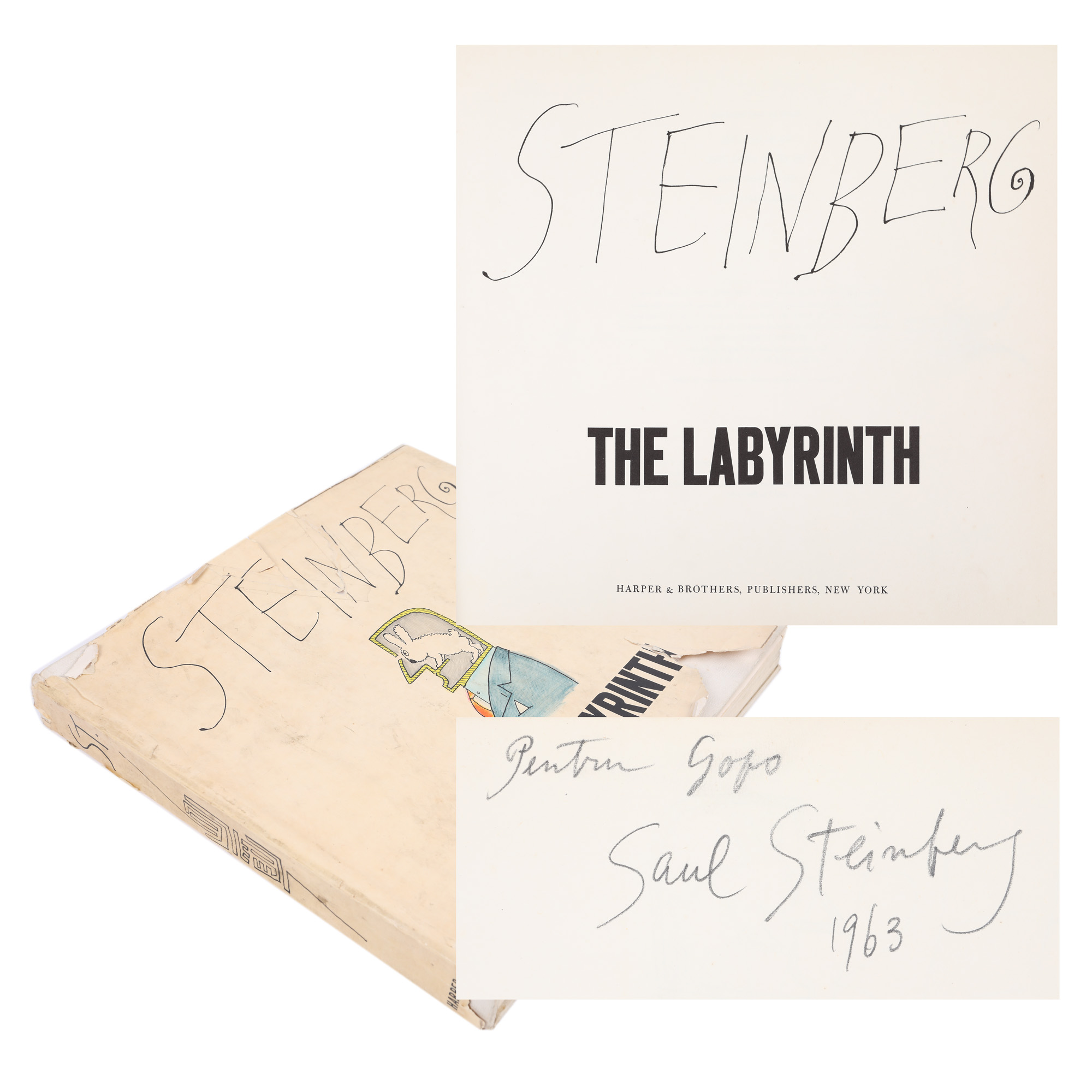
124. "The Labyrinth", by Saul Steinberg, New York, 1960, with 341 lithographs and the author’s dedication to Ion Popescu Gopo
Starting price
EUR 100
Sold
EUR 100